Bannau Brycheiniog (Brecon Beacons) National Park for the Car-Free Visitor
Bannau Brycheiniog spans four mountain ranges with only three railheads and two bus corridors linking them. Here is how to navigate the park without a car.
- Flag
-

- ISO code
- GB
- Currency
- GBP
- Timezone
- Europe/London
Hiking Bannau Brycheiniog by Bus and Train
You want to hike the Brecon Beacons without a car. You can, but only if you accept two things. The interior trailheads are deliberately inaccessible by public transport. And you must plan your days around the four bus corridors and three railheads that frame this 520-square-mile park.
Bannau Brycheiniog is not one landscape. It is four distinct upland ranges scattered across Powys, Monmouthshire and Carmarthenshire, connected by the TrawsCymru bus network and the railway line at Abergavenny. The park authority renamed the area from "Brecon Beacons" to "Bannau Brycheiniog" on 17 April 2023, adopting the plural of "ban" (peak) and the kingdom of King Brychan to signal a commitment to Welsh language and deeper cultural heritage. That shift in name matches a shift in expectation: this is not a single city of peaks you can tick off in an afternoon. It is a sprawling region where the distance between the Black Mountains in the east and the Black Mountain in the west is a full hour by taxi, and where the weather can turn from June sunshine to disorienting hill fog in fifteen minutes.
Dedicated hikers, wild swimmers, stargazers chasing the 2013 International Dark Sky Reserve status, and military fitness enthusiasts on the Pen y Fan Fan Dance route will find exactly what they came for. Casual day-trippers reliant on public transport will find their plans broken by the absence of buses to any trailhead. The single thing that trips visitors up is assuming a postcode on a sat-nav will take them to a car park entrance, which often leads to a dead-end farm track with no turning space. You do not have that problem because you are not driving. Your problem is different: getting to the start before the crowds arrive on a day when the weather holds. The approach that works is tackling the park corridor by corridor. Check Traveline Cymru for live times before you travel.

.jpg)
- Area: 520 sq mi (1,347 km²)
- Counties: Powys, Monmouthshire, Carmarthenshire
- Designation: National Park (established 1957)
- Welsh Name: Bannau Brycheiniog
- English Name: Brecon Beacons
- Renaming Date: 17 April 2023
- Number of Distinct Ranges: 4
- Highest Point: Pen y Fan (886 m)
- Rail Entry Points: Abergavenny (Welsh Marches Line), Merthyr Tydfil (Merthyr Line), Llandovery (Heart of Wales Line)
- Rail Service to Brecon Town: None (closed 1962; replaced by the Taff Trail)
- Key Bus Corridor: TrawsCymru T4 (Cardiff, Merthyr Tydfil, Brecon, Llandrindod Wells, Newtown), T14 (Hereford, Hay-on-Wye, Brecon), X43 (Abergavenny, Crickhowell, Brecon)
- Dark Sky Reserve Status: Granted 2013, covers entire national park
- UNESCO Global Geopark: Fforest Fawr UNESCO Global Geopark (designated 2005, 763 km² in the western half)
- Bus Journey Planner: Traveline Cymru (www.traveline.cymru)
The Three Railheads and the Bus Corridors
The park has three railway stops that matter. Abergavenny on the Welsh Marches Line (Newport to Hereford corridor) opens up the Black Mountains and the eastern park. Merthyr Tydfil on the Merthyr Line from Cardiff opens up the Central Beacons and Pen y Fan from the south. Llandovery on the Heart of Wales Line (Swansea to Shrewsbury corridor) opens up the Black Mountain and the far west. Brecon town itself has no railway. The Brecon and Merthyr Railway closed to passengers in 1962. The trackbed is now the Taff Trail, a long-distance walking and cycling route you can use to approach the park on foot from the south. It does not replace a train service.
From each railhead, you connect to the interior via bus corridors.
Abergavenny: The Eastern Gateway
Arrive at Abergavenny. Walk across the road to the bus stop on Monk Street. Catch the TrawsCymru X43 toward Brecon. That bus runs several journeys daily, less on Sundays. It passes through Crickhowell, a gastropub hub with a ruined castle and gentler riverside walks, and Talybont-on-Usk, a linear village that gives you access to the Talybont Reservoir and mountain biking trails. The X43 does not take you to any trailhead. It drops you in the towns. From Crickhowell, walk onto the Black Mountains by following the ridge paths east. From Talybont, walk the Taff Trail or the ascent toward the Central Beacons. For the direct approach to the Black Mountains, get off the X43 at Crickhowell and walk south-east across the common. The ascent is rough and steep. You avoid the car entirely. Budget 45 minutes from the bus stop to the open moor.
For Hay-on-Wye, stay on the X43 to Brecon then catch the TrawsCymru T14 (Hereford to Hay-on-Wye to Brecon, several journeys daily, reduced Sunday). Hay sits on the park's fringe with its bookshops and literary festival fame. The Hay Bluff escarpment, a hang-gliding launch site with an edge-of-the-world view, is walkable from the town centre via the Offa's Dyke Path, about 5 miles one way. No bus goes to the bluff car park.
Merthyr Tydfil: The Southern Approach
Merthyr Tydfil is closer to Pen y Fan than any other public transport point. The TrawsCymru T4 runs roughly hourly from the bus station (a five-minute walk from the train stop) north to Brecon. The bus passes Pont ar Dafydd and the Storey Arms, the two main trailheads for the Pen y Fan horseshoe. But the bus does not stop at the trailheads. It stops at the designated lay-bys on the A470. You can request to alight at Pont ar Dafydd. The driver will pull into the lay-by. This is the closest you will get to a trailhead without a car. From that lay-by, you are on the path to Corn Du and Pen y Fan in ten minutes.
The problem: Pont ar Dafydd car park is critically full by 8:30 AM on weekends. The bus does not run early enough to beat that. The first T4 from Merthyr departs around 7:00 AM, reaching Pont ar Dafydd by about 7:30. That works. The summer peak between April and September means daylight until 9 PM. You have a long window. On a July Tuesday, the summit of Pen y Fan can feel like a queue. Do not attempt this on a Sunday in August with the later first bus. You will hit the crowds and the cloud.
From the same T4, alight at the Storey Arms stop, a larger lay-by that also serves as the start of the less crowded route up Corn Du. Both stops give you the same access to the Central Beacons. The Storey Arms lay-by also allows access to the western edge of the range and the start of the route toward Fforest Fawr.
Llandovery: The Western Door
Llandovery is on the Heart of Wales Line, a single-track railway with limited service. From here, your options are limited. No bus reaches the Black Mountain trailheads. The TrawsCymru network does not serve the far west at useful frequencies. You can walk from the town south onto the open moor of the Black Mountain (remote moorland, glacial lakes, escarpment edges). It is a 10-mile approach each way. This is a two-day proposition.
Alternatively, take a taxi from the stop to the Llyn y Fan Fach trailhead. The glacial lake beneath the cliff holds the Lady of the Lake legend. The taxi fare is roughly GBP 15 to GBP 20 one way. The same applies to Llyn y Fan Fawr and the start of the ascent onto the Black Mountain escarpment. Budget GBP 40 to GBP 50 round trip. No taxi company operates a meter; negotiate the fare at the rank. Cash is expected. Mobile signal vanishes in the valleys, so arrange the return pickup in advance, specifying a time. If the weather window shifts, you cannot call to adjust. Download offline OS Maps or AllTrails before leaving Llandovery.
The Districts and What Each Requires from the Car-Free Visitor
The four ranges demand different strategies. The Central Beacons are the most accessible because the T4 runs the A470 corridor directly past the trailheads. The Black Mountains are reachable from Abergavenny via the X43 to Crickhowell, then a walk. Waterfall Country (the Ystradfellte area, part of Fforest Fawr) is the least accessible without a car. The Four Waterfalls Walk, Sgwd yr Eira (the waterfall you can walk behind), and the steep gorges require a taxi from Merthyr Tydfil or a long walk from the T4 stop at Glynneath. The pay-and-display car parks have no bus service. The nearest taxi from Merthyr costs roughly GBP 20 each way. The walks are slippery, the spray is relentless, and the valleys are dead zones for phone signal. Download the route before you go.
The Fforest Fawr Geopark area, with its limestone pavements and hidden caves, has no bus access at all. The caves at Dan-yr-Ogof Showcaves (a commercialised complex with a dinosaur park attached) and the National Showcaves Centre require a taxi from either Llandovery or Merthyr. Budget GBP 25 each way. The UNESCO Global Geopark designation, awarded in 2005, covers 763 square kilometres of the western half of the park. A mile from the road, you will see almost no other people.
The Llangattock Escarpment, with its vertical cliffs, abandoned quarries and subterranean boat trips, is walkable from Crickhowell. Follow the canal path east from the village, then climb the escarpment path. No bus goes to the quarry entrances.
Brecon town itself is the hub. The T4, T14 and X43 all converge here. It is a small Georgian basecamp with a canal basin and independent bookshops. You will find Pen-y-Cae Farm sausages at the market, Welsh lamb cawl in the pubs, and Brecon Gin in most bars. The Brecon Mountain Railway, a vintage steam service to the reservoirs, operates from a stop a mile north of the town centre. Walk there along the canal.
| Range | Nearest Railhead | Bus Corridor | Nearest Bus Stop To Trailhead | Walk From Bus Stop (Minutes) | Taxi Option Cost (GBP) |
|---|---|---|---|---|---|
| Central Beacons (Pen y Fan, Corn Du) | Merthyr Tydfil | TrawsCymru T4 | Pont ar Dafydd / Storey Arms lay-bys | 5 to 10 minutes | Not needed; direct bus |
| Black Mountains (Hay Bluff, Sugar Loaf) | Abergavenny | X43 to Crickhowell or T14 to Hay-on-Wye | Crickhowell High Street / Hay-on-Wye town centre | 45 to 60 minutes ridge walk | GBP 15 to 20 from Abergavenny |
| Fforest Fawr & Waterfall Country (Four Waterfalls, Sgwd yr Eira) | Merthyr Tydfil or Neath | None to trailheads | None; taxi required | N/A | GBP 20 to 25 each way from Merthyr |
| Black Mountain (Llyn y Fan Fach, Llyn y Fan Fawr) | Llandovery | None to trailheads | None; taxi required | 10 miles on foot from Llandovery | GBP 15 to 20 each way from Llandovery |
| Brecon Town (base, accommodation, supplies) | None (nearest: Abergavenny or Merthyr) | T4, T14, X43 | Brecon bus station | N/A (town centre) | GBP 40 to 50 from Cardiff Airport |


What to Book and When to Move
You need three full days minimum. One for the Central Beacons horseshoe (Pen y Fan and Corn Du), one for Waterfall Country, and one for the Black Mountain. That schedule assumes no weather losses. If the summit is shrouded in cloud, waste no time: switch to the low-level Waterfall Country or the Taff Trail cycle path. Do not wait for clearance. The peaks are frequently shrouded.
Book accommodation in Brecon or Crickhowell. Both sit on the X43 and T4 corridors. Avoid the Royal Welsh Show week in late July at Builth Wells, which floods every B&B and road within 40 miles. Avoid the Brecon Jazz Festival weekend in August if you want quiet trails. November is reliably wet, grey, and has the shortest days before proper winter snow.
The peak season runs April to September, peaking sharply during school Easter holidays and August. The Dark Sky Reserve status means clear nights in autumn and winter offer the best stargazing. You need the patience for short days and cold dawns. Six Dark Sky Discovery Sites exist within the park; none have bus access. You will walk or taxi to them.
The MOD firing range at Sennybridge closes large sections of the western park without much online notice. Red flags mean no access. Check the Sennybridge range firing times online before you travel. If the range is active, the Black Mountain is off limits and you lose your third day.
Common Mistake To Skip
Visitors try to tick off Pen y Fan, the Black Mountain and the waterfalls in a single day. They spend more time in the car than on the trail. You have no car. That mistake is not available to you. But you can still make the equivalent error: attempting the Pen y Fan horseshoe from the Storey Arms on a summer weekend without an early start. The T4 buses fill with day-trippers. The summit path becomes a queue. Start by 7:30 AM. The first bus from Merthyr gets you there in time. The last bus back from Brecon runs until around 8 PM in summer. Check the Traveline Cymru app for the specific timetable on the day you travel; frequency varies by section and day.
Fuel, Signal And The Friction Of The West
Fuel stations are scarce in the interior. You do not have a car, so this is not your problem. Mobile signal vanishes in Waterfall Country and the Black Mountain. EE and Vodafone offer the least patchy 4G over the high ridges. Do not rely on it. Download offline maps (OS Maps or AllTrails) before leaving accommodation. Do not rely on a cafe's Wi-Fi at the trailhead; there often is not a cafe. Livestock, especially sheep, have absolute right of way on unfenced mountain roads. You are walking, so you step aside. The delay is minimal unless a full flock blocks the path.
Contactless payments at remote honesty-box car parks are impossible without signal. You are not parking, so this is irrelevant. But if you arrange a taxi pickup at an unmanned trailhead, carry cash.
Places in Brecon Beacons
-
 Abergavenny
 is the rail gateway to Bannau Brycheiniog, with a mainline station, a walk-up Sugar Loaf, a foodie reputation, and the taxi rank that gets you to Pen y Fan.
Abergavenny
Abergavenny is the rail gateway to Bannau Brycheiniog, with a mainline station, a walk-up Sugar Loaf, a foodie reputation, and the taxi rank that gets you to Pen y Fan.
-
 Brecon
 town is the bus network's hub for Bannau Brycheiniog, with walkable Georgian streets, a canal basin, and the only place the T4 and T14 routes meet.
Brecon
Brecon town is the bus network's hub for Bannau Brycheiniog, with walkable Georgian streets, a canal basin, and the only place the T4 and T14 routes meet.
-
 Crickhowell
 sits on the T4 bus corridor between Brecon and Abergavenny, with a walk-up Table Mountain, a gastropub high street, and a bus in both directions.
Crickhowell
Crickhowell sits on the T4 bus corridor between Brecon and Abergavenny, with a walk-up Table Mountain, a gastropub high street, and a bus in both directions.
-
 Hay-on-Wye
 is reachable by the TrawsCymru bus corridor from Brecon, with bookshops, the festival site, and Hay Bluff all walkable from the town centre stop.
Hay-on-Wye
Hay-on-Wye is reachable by the TrawsCymru bus corridor from Brecon, with bookshops, the festival site, and Hay Bluff all walkable from the town centre stop.
-
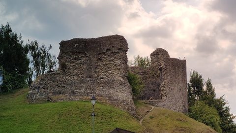 Llandovery
 railway station on the Heart of Wales line is the western railhead for the Black Mountain, with taxis to Carreg Cennen and long walk-ins for Llyn y Fan Fach.
Llandovery
Llandovery railway station on the Heart of Wales line is the western railhead for the Black Mountain, with taxis to Carreg Cennen and long walk-ins for Llyn y Fan Fach.
-
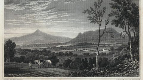 Talgarth
 is reached by the TrawsCymru bus from Brecon, with a working watermill, bakery, and waterfall walks starting from the town square bus stop.
Talgarth
Talgarth is reached by the TrawsCymru bus from Brecon, with a working watermill, bakery, and waterfall walks starting from the town square bus stop.
What to See in Brecon Beacons
-
 Dan-yr-Ogof National Showcaves
Dan-yr-Ogof pairs genuine caves with an unexpected dinosaur park. Reach it by bus to Abercrave then a road walk, or by taxi from Neath railway station.
Dan-yr-Ogof National Showcaves
Dan-yr-Ogof pairs genuine caves with an unexpected dinosaur park. Reach it by bus to Abercrave then a road walk, or by taxi from Neath railway station.
-
 Llangorse Lake
 is a short, flat walk from the bus stop on the TrawsCymru corridor from Brecon, with a crannog, bird hides, and watersports at the water's edge.
Llangorse Lake
Llangorse Lake is a short, flat walk from the bus stop on the TrawsCymru corridor from Brecon, with a crannog, bird hides, and watersports at the water's edge.
-
 Llanthony Priory
 lies in a dead-end valley with no bus service. Here's how to reach it by taxi from Hay-on-Wye or on foot from the Hay Bluff escarpment.
Llanthony Priory
Llanthony Priory lies in a dead-end valley with no bus service. Here's how to reach it by taxi from Hay-on-Wye or on foot from the Hay Bluff escarpment.
-
 Pen y Fan
 can be climbed from the Storey Arms bus stop on the TrawsCymru corridor, with quieter alternatives from Cwm Gwdi and a long walk-in from Brecon.
Pen y Fan
Pen y Fan can be climbed from the Storey Arms bus stop on the TrawsCymru corridor, with quieter alternatives from Cwm Gwdi and a long walk-in from Brecon.
-
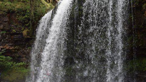 Waterfall Country
's Four Waterfalls Walk is reachable by a long road-walk from the nearest bus stop or by taxi from Abergavenny station, with slippery paths year-round.
Waterfall Country
Waterfall Country's Four Waterfalls Walk is reachable by a long road-walk from the nearest bus stop or by taxi from Abergavenny station, with slippery paths year-round.
More on Brecon Beacons
-
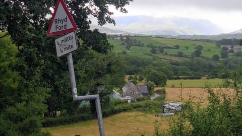 Walks in the Brecon Beacons That Start and Finish at a Bus Stop
A handpicked list of Brecon Beacons walks that genuinely start and end at a bus stop, from Sugar Loaf to the canal towpath, with mountain safety woven in.
Walks in the Brecon Beacons That Start and Finish at a Bus Stop
A handpicked list of Brecon Beacons walks that genuinely start and end at a bus stop, from Sugar Loaf to the canal towpath, with mountain safety woven in.
-
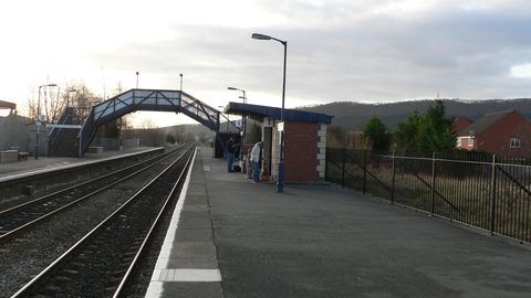 Trains to Bannau Brycheiniog: Railway Stations That Serve the Brecon Beacons
No train runs through the Brecon Beacons, but stations at Abergavenny, Merthyr Tydfil, Llandovery, and Neath ring the park. Here is how to connect onward from each.
Trains to Bannau Brycheiniog: Railway Stations That Serve the Brecon Beacons
No train runs through the Brecon Beacons, but stations at Abergavenny, Merthyr Tydfil, Llandovery, and Neath ring the park. Here is how to connect onward from each.
-
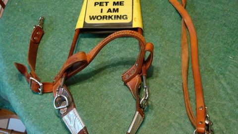 Walking With Dogs in the Brecon Beacons Rules That Are Not Suggestions
The legal rules and real risks of walking a dog in Bannau Brycheiniog, from sheep on Pen y Fan to slippery Waterfall Country paths, plus dog-friendly bus and pub access.
Walking With Dogs in the Brecon Beacons Rules That Are Not Suggestions
The legal rules and real risks of walking a dog in Bannau Brycheiniog, from sheep on Pen y Fan to slippery Waterfall Country paths, plus dog-friendly bus and pub access.
-
 Taxis and Baggage Transfers in the Brecon Beacons Without a Car
Taxi firms, approximate fares and baggage transfer services that unlock Bannau Brycheiniog's trailheads when the bus stops short, from Abergavenny to Pen y Fan to Llandovery to the Black Mountain.
Taxis and Baggage Transfers in the Brecon Beacons Without a Car
Taxi firms, approximate fares and baggage transfer services that unlock Bannau Brycheiniog's trailheads when the bus stops short, from Abergavenny to Pen y Fan to Llandovery to the Black Mountain.
-
 Reading the Map Welsh Place Names That Describe the Brecon Beacons
What the Welsh words on the Bannau Brycheiniog map really mean—from bannau and cwm to sgwd and blaen—and how they describe the ground before you set foot on it.
Reading the Map Welsh Place Names That Describe the Brecon Beacons
What the Welsh words on the Bannau Brycheiniog map really mean—from bannau and cwm to sgwd and blaen—and how they describe the ground before you set foot on it.
-
 Mountain Safety in the Brecon Beacons What Actually Goes Wrong
The specific mountain hazards in Bannau Brycheiniog that catch walkers out, from Pen y Fan summit fog to Waterfall Country's slick gorges, and how to prepare without a car.
Mountain Safety in the Brecon Beacons What Actually Goes Wrong
The specific mountain hazards in Bannau Brycheiniog that catch walkers out, from Pen y Fan summit fog to Waterfall Country's slick gorges, and how to prepare without a car.
-
 The Beacons Bus and What Replaced It: Buses Into Bannau Brycheiniog Now
The seasonal Beacons Bus has come and gone. Here is what runs now on the TrawsCymru corridors, what doesn't, and why you must check Traveline Cymru before travelling.
The Beacons Bus and What Replaced It: Buses Into Bannau Brycheiniog Now
The seasonal Beacons Bus has come and gone. Here is what runs now on the TrawsCymru corridors, what doesn't, and why you must check Traveline Cymru before travelling.
-
 The Beacons Way Without a Car: An Eight-Day Walk Across Bannau Brycheiniog
The Beacons Way crosses Bannau Brycheiniog from Abergavenny station to Llangadog. Here is how to manage the start, finish, and baggage logistics without a car.
The Beacons Way Without a Car: An Eight-Day Walk Across Bannau Brycheiniog
The Beacons Way crosses Bannau Brycheiniog from Abergavenny station to Llangadog. Here is how to manage the start, finish, and baggage logistics without a car.
-
 Stargazing in the Brecon Beacons Dark Sky Reserve Without a Car
How to stargaze in the Bannau Brycheiniog Dark Sky Reserve without a car, from bus-accessible spots near Brecon town to the remote dark core zones that need a taxi.
Stargazing in the Brecon Beacons Dark Sky Reserve Without a Car
How to stargaze in the Bannau Brycheiniog Dark Sky Reserve without a car, from bus-accessible spots near Brecon town to the remote dark core zones that need a taxi.
-
 Bunkhouses and Hostels in the Brecon Beacons Reachable Without a Car
The bunkhouses, hostels and camping barns in Bannau Brycheiniog you can reach by TrawsCymru bus or train, plus the ones that need a taxi from Abergavenny or Llandovery station.
Bunkhouses and Hostels in the Brecon Beacons Reachable Without a Car
The bunkhouses, hostels and camping barns in Bannau Brycheiniog you can reach by TrawsCymru bus or train, plus the ones that need a taxi from Abergavenny or Llandovery station.
-
 Accessible Days Out in the Brecon Beacons That Do Not Need a Mountain
Accessible and gentle days out in Bannau Brycheiniog that don't need a mountain or a car, from the Brecon canal towpath to the Brecon Mountain Railway and Big Pit.
Accessible Days Out in the Brecon Beacons That Do Not Need a Mountain
Accessible and gentle days out in Bannau Brycheiniog that don't need a mountain or a car, from the Brecon canal towpath to the Brecon Mountain Railway and Big Pit.
-
 The Monmouthshire and Brecon Canal Towpath as a Traffic-Free Spine
How to walk or cycle the Monmouthshire and Brecon Canal towpath as a flat, traffic-free spine through Bannau Brycheiniog, with every access point linked to a bus stop or railway station.
The Monmouthshire and Brecon Canal Towpath as a Traffic-Free Spine
How to walk or cycle the Monmouthshire and Brecon Canal towpath as a flat, traffic-free spine through Bannau Brycheiniog, with every access point linked to a bus stop or railway station.
-
 Brecon or Abergavenny as a Base for Bannau Brycheiniog Without a Car
Brecon has the bus hub and canal-basin calm; Abergavenny has the railway station and foodie bustle. We compare both for a car-free stay in Bannau Brycheiniog.
Brecon or Abergavenny as a Base for Bannau Brycheiniog Without a Car
Brecon has the bus hub and canal-basin calm; Abergavenny has the railway station and foodie bustle. We compare both for a car-free stay in Bannau Brycheiniog.
-
 Bannau Brycheiniog or Eryri for a Walking Trip by Train and Bus
Eryri runs Sherpa buses to its trailheads; Bannau Brycheiniog leaves you at a pub eight miles from the hill. An honest comparison for car-free walkers choosing between Wales's two iconic parks.
Bannau Brycheiniog or Eryri for a Walking Trip by Train and Bus
Eryri runs Sherpa buses to its trailheads; Bannau Brycheiniog leaves you at a pub eight miles from the hill. An honest comparison for car-free walkers choosing between Wales's two iconic parks.
-
 Beacons Way or Offa's Dyke Path for a Long Walk in the Welsh Marches
The Beacons Way crosses the roof of Bannau Brycheiniog; Offa's Dyke traces the border. We compare both long trails for walkers arriving by train, with no car.
Beacons Way or Offa's Dyke Path for a Long Walk in the Welsh Marches
The Beacons Way crosses the roof of Bannau Brycheiniog; Offa's Dyke traces the border. We compare both long trails for walkers arriving by train, with no car.
Common Questions
Is there a train station in Brecon town?
No. Brecon lost its railway in 1962 when the Brecon and Merthyr Railway closed to passengers. The nearest stations are Abergavenny (Welsh Marches Line, buses to Brecon via the X43), Merthyr Tydfil (Merthyr Line, buses to Brecon via the T4), and Llandovery (Heart of Wales Line, limited onward transport).
Can I reach the Pen y Fan car park by public transport?
The Pont ar Dafydd and Storey Arms lay-bys on the A470 are the closest you can get. The TrawsCymru T4 from Merthyr Tydfil or Brecon will stop at these lay-bys if you ask the driver. The walk from the lay-by to the summit is about ten minutes for Corn Du, twenty-five for Pen y Fan. The lay-bys are not official stops; tell the driver your destination before boarding.
Which range is easiest to visit without a car?
The Central Beacons, using the T4 bus corridor from Merthyr Tydfil or Brecon. The bus passes directly beside the main trailheads. The Black Mountains are second-easiest via the X43 from Abergavenny to Crickhowell, then a 45-minute ridge walk to the open moor. Waterfall Country and the Black Mountain require taxis.
What is the cheapest way to reach the park from a major airport?
Fly into Cardiff Airport (CWL). Take the bus to Cardiff city centre, then the TrawsCymru T4 to Brecon. The full journey takes about two and a half hours and costs roughly GBP 15 to 20 in bus fares. An airport taxi to Brecon costs roughly GBP 70 to 90. Bristol Airport (BRS) is a 1.5-hour drive; a taxi from Bristol Airport to Brecon costs roughly GBP 80 to 100 with no direct bus connection.
How do I visit Waterfall Country without a car?
Take a taxi from Merthyr Tydfil to the Four Waterfalls Walk car park, roughly GBP 20 each way. No bus serves the Ystradfellte area. Arrange the return taxi in advance because mobile signal vanishes in the gorges. The walk is a pay-and-display circuit; carry cash because the honesty box has no signal for contactless. The path is extremely slippery.
Is the park accessible year-round by bus?
The T4 and X43 run year-round with reduced Sunday frequency. The T14 (Hereford to Hay-on-Wye to Brecon) also runs year-round but with fewer journeys. December 25 and January 1 have no service. The Heart of Wales line to Llandovery runs on Sundays but with a limited timetable. Check Traveline Cymru before travel.
What do I do if my chosen trailhead has no bus and I cannot afford a taxi?
Walk from the nearest bus stop or rail station. The Taff Trail, a long-distance walking and cycling route on the former railway trackbed from Merthyr to Brecon, gives you 30 miles of traffic-free access through the eastern edge of the park. It connects to Talybont-on-Usk and the Central Beacons approach paths. It does not reach Waterfall Country or the Black Mountain.
Read next
-
 Brecon Beacons Hotels: Country Houses, Coaching Inns and the Festival Premium
The best hotels in Bannau Brycheiniog are those you can reach by train or bus. Here are the coaching inns and country houses with a bus stop or platform nearby.
Brecon Beacons Hotels: Country Houses, Coaching Inns and the Festival Premium
The best hotels in Bannau Brycheiniog are those you can reach by train or bus. Here are the coaching inns and country houses with a bus stop or platform nearby.
-
 Where to Stay in the Brecon Beacons Ranked by What You Can Reach on Foot
The best base in Bannau Brycheiniog is the one where you can lace your boots and walk onto the hill. Here is every town ranked by what leaves from the door.
Where to Stay in the Brecon Beacons Ranked by What You Can Reach on Foot
The best base in Bannau Brycheiniog is the one where you can lace your boots and walk onto the hill. Here is every town ranked by what leaves from the door.
-
 Flying into Bannau Brycheiniog via Cardiff Bristol and Birmingham
Flying into Bannau Brycheiniog: how to reach the park by train and bus from Cardiff, Bristol and Birmingham airports, with taxi costs where public transport fails.
Flying into Bannau Brycheiniog via Cardiff Bristol and Birmingham
Flying into Bannau Brycheiniog: how to reach the park by train and bus from Cardiff, Bristol and Birmingham airports, with taxi costs where public transport fails.
-
 Things to Do in Bannau Brycheiniog Sorted by Whether You Have a Car
Some of Bannau Brycheiniog's finest walks begin at bus stops. Others require a taxi or a long approach on foot. Here is every major activity sorted by access.
Things to Do in Bannau Brycheiniog Sorted by Whether You Have a Car
Some of Bannau Brycheiniog's finest walks begin at bus stops. Others require a taxi or a long approach on foot. Here is every major activity sorted by access.
-
 Best Time to Visit Bannau Brycheiniog Month by Month Including Daylight Hours
August brings queues to Pen y Fan's summit, November loses the light by four, and the Royal Welsh Show swallows every bed for miles. Here is the park month by month.
Best Time to Visit Bannau Brycheiniog Month by Month Including Daylight Hours
August brings queues to Pen y Fan's summit, November loses the light by four, and the Royal Welsh Show swallows every bed for miles. Here is the park month by month.
-
 Getting Around the Brecon Beacons Without a Car: What Runs and What Does Not
No bus reaches the trailheads of Bannau Brycheiniog. Here is what the TrawsCymru network does serve, and what to do when the tarmac runs out.
Getting Around the Brecon Beacons Without a Car: What Runs and What Does Not
No bus reaches the trailheads of Bannau Brycheiniog. Here is what the TrawsCymru network does serve, and what to do when the tarmac runs out.
-
Pen y Fan
Pen y Fan can be climbed from the Storey Arms bus stop on the TrawsCymru corridor, with quieter alternatives from Cwm Gwdi and a long walk-in from Brecon.
-
Waterfall Country
Waterfall Country's Four Waterfalls Walk is reachable by a long road-walk from the nearest bus stop or by taxi from Abergavenny station, with slippery paths year-round.
-
Llangorse Lake
Llangorse Lake is a short, flat walk from the bus stop on the TrawsCymru corridor from Brecon, with a crannog, bird hides, and watersports at the water's edge.