Bannau Brycheiniog Walks That Begin and End at a Bus Stop
A handpicked list of Brecon Beacons walks that genuinely start and end at a bus stop, from Sugar Loaf to the canal towpath, with mountain safety woven in.


Five Car-Free Trailheads in Bannau Brycheiniog
The TrawsCymru T4 stops at the base of Table Mountain in Crickhowell. Get off and start the 7 km circuit immediately. No road walking. That is the standard for every walk here: the trailhead matches a bus stop on the Stagecoach South Wales network. If you arrive in Bannau Brycheiniog without a car, these five routes work. The bus delivers you directly and the stop is the trailhead.
Failure case: the day's last bus leaves before you finish. Check Traveline Cymru on 0800 464 0000 or traveline.cymru before you start. Do this before you set off, not while you are descending a ridge in fog. The T4 runs roughly hourly between Abergavenny and Brecon. The A470 Merthyr to Brecon corridor is also roughly hourly. The Brecon to Hay road runs every two hours. Missing the last bus from a request stop like Bwlch or Llangorse means a 20 mile walk or a taxi that costs more than your accommodation. Plan the return, not just the route.
The Five Bus Stop Walks That Work
Table Mountain From Crickhowell T4 Stop
The T4 drops you in Crickhowell village centre next to the bridge. The Table Mountain circuit is 7 km with 380 m ascent. Allow 2.5 to 3 hours. You climb immediately up the escarpment edge, cross the flat summit plateau, and descend a grassy ridge back into Crickhowell. The path is clear. The summit is exposed. On a July afternoon, high cloud can drop visibility to 50 metres in ten minutes. Carry a waterproof, a map, and know your compass bearings even on a gentle walk. The hill safety rule here applies at 380 m of ascent, not just 1000 m.
Sugar Loaf From Abergavenny Bus Station
From Abergavenny bus station, walk 15 minutes through the town centre to the footpath start at the edge of the Deri Road estate. The round trip to the summit and back is 10 km with 480 m ascent. Budget 3.5 to 4 hours. Sugar Loaf is a standalone hill, not part of a ridge. The wind accelerates across its flanks. In winter or after a cold front passes, the wind chill at the trig point can be 10 degrees below the valley temperature. Layer up before the climb, not at the summit. Your fingers will be too cold to tie a knot by then. The path is well used, but the trig point area is not sheltered. If the cloud base sits at 400 m, you are walking blind for the top third of the route. Know the line of descent before you leave the car park, not after you lose the path.
Monmouthshire And Brecon Canal Towpath From Brecon Bus Station
This is the failsafe walk for weather that rules out high ridges. The towpath extends from Brecon bus station south toward Abergavenny. Pick any two villages with bus stops on the A40 corridor and walk the section between them. A typical 5 to 12 km stretch takes 1.5 to 3.5 hours on flat, lock-free ground. The ascent is negligible. You walk beside still water under tree cover. The safety trade-off: the canal side is hidden from roads and mobile signal. EE and Vodafone offer the least patchy 4G on high ridges, but the canal valley is a dead zone. Download offline OS Maps or AllTrails before you leave your accommodation. Do not rely on cafe Wi-Fi at Brecon basin. The cafe closes by 4 PM and the bus shelter has no signal. The Stagecoach timetable has an hourly departure from Brecon to Abergavenny. Arrive at the bus station 10 minutes early, not 2. The driver will not wait if the stop is empty at a request halt like Bwlch.
Taff Trail Section From Merthyr Tydfil Station
Merthyr Tydfil railway station connects to the Taff Trail via a signed link through the town centre. The section north to Brecon runs 16 km with 520 m total ascent, taking 5 to 6 hours. This is a linear walk: you start at Merthyr and finish at Brecon bus station on the A470 corridor. The bus back is roughly hourly. The Taff Trail follows an old railway line, then a reservoir shore, then an open hillside above Talybont Reservoir. The weather changes fast on the exposed section between Pontsticill and Talybont. A clear blue sky at the station can become disorienting hill fog on the dam wall in 20 minutes. The path is waymarked but the fog lifts the colour contrast off the markers. Carry a compass and know the heading from the dam wall to the re-entrant that holds the path. If the fog is down and you have no compass, stop. Wait for a clearing. Do not guess the direction. The Taff Trail is wide enough for two people side by side, but a wrong turn into the forestry blocks adds two hours.
Table Mountain Above Crickhowell From The T4 Stop
The T4 bus stops in Crickhowell village. The 7 km circuit for Table Mountain starts from the bus stop. Walk directly toward the hill on a signed path from the village green. The Table Mountain ridge is a limestone escarpment with a flat top. Sheep graze the summit plateau. The path is a circuit, so you return to the same bus stop. If you finish the walk in 2.5 hours, you can catch the next bus in either direction without a long wait. If you finish in 2 hours, sit at the stop and wait. Do not try to walk toward the next village. The A40 has no footpath and the traffic moves at 60 mph.
How to Use the Bus Network for Walking
Request Stops And The Storey Arms Example
The Storey Arms layby on the A470 is a request stop on the Merthyr to Brecon corridor. The bus only stops if you signal the driver. Stand at the roadside with your arm out clearly, not holding a phone or a map. To return, you must catch the bus from the same layby, not from a different spot 200 metres away. The driver will not stop for you twice. The Pen y Fan route from Storey Arms to Brecon is 16 km with 520 m ascent, taking 5 to 6 hours. The summit is Pen y Fan, the highest peak in southern Britain. The queue on a Tuesday in July is real. If the summit is crowded, skip the top and traverse Corn Du beside it. Corn Du is quieter, has a Bronze Age cairn, and the view is almost identical. The descent into Brecon runs down a grassy ridge into the town. The last bus from Brecon to Merthyr leaves at approximately 19:00 but check the timetable on the day. Stagecoach South Wales adjusts for school holidays.
The Bwlch To Llangorse Linear Walk
The T4 drops you at Bwlch village on the A40. The walk to Llangorse Lake is 9 km with 120 m ascent, taking 2.5 to 3 hours. You walk through farmland on a quiet country lane and then across a flat valley floor to the lake. The return bus from Llangorse village runs on the Brecon to Hay road corridor, which comes every two hours. Miss the bus, and you wait two hours in a village with no cafe, no shop, and no mobile signal. The Pub By The Crannog on the lakeshore closes its kitchen at 2:30 PM between lunch and evening service. Carry food and water. If you walk to Llangorse intending to eat lunch, eat before 2:30 or after 6 PM. The walk is easy. The bus schedule is not. This is the walk where the failure case is not weather, it is timing.
Waterfall Country From The Swansea Valley Bus
First Cymru runs the roughly hourly corridor from Swansea to Brecon via Ystradgynlais. Get off at Pontneddfechan. The waterfall circuit from here runs 8 to 14 km with 200 to 350 m ascent, taking 3 to 5 hours. The path crosses slippery, damp rock. The famous Sgwd yr Eira waterfall lets you walk behind the curtain. The spray coats the path for 50 metres on either side. The footing is greasy limestone and worn mud. Trainers are inadequate. Wear boots with a deep tread and carry a dry bag for your phone. The spray in Waterfall Country is relentless even in August. The gorge traps moisture and cold air. The temperature at the base of Sgwd yr Eira can be 6 degrees cooler than the valley top. Hypothermia risk is real on a wet July day if you walk in a t-shirt. The path is waymarked but the route between Pontneddfechan and Ystradfellte is not a perfect loop. Study the map before you enter the gorge. The desire path at the top of Sgwd yr Eira leads to a dead end above the drop. Do not follow a GPS trail that cuts corners; the cliff edge is not fenced.


| Walk | Bus Stop | Distance | Ascent | Duration | Bus Back |
|---|---|---|---|---|---|
| Table Mountain | Crickhowell T4 | 7 km | 380 m | 2.5-3 hrs | Same stop, roughly hourly |
| Sugar Loaf | Abergavenny Bus Station | 10 km | 480 m | 3.5-4 hrs | Same stop, roughly hourly |
| Canal Towpath | Brecon Bus Station | 5-12 km | Negligible | 1.5-3.5 hrs | A40 villages, roughly hourly |
| Taff Trail | Merthyr Tydfil Station | 16 km | 520 m | 5-6 hrs | Brecon station, roughly hourly |
| Waterfall Country | Pontneddfechan | 8-14 km | 200-350 m | 3-5 hrs | Circuit or Ystradfellte stop |
When the Walk Does Not Go to Plan
Common mistake: you assume the bus timetable you checked at 8 AM still holds at 4 PM. The Stagecoach South Wales schedule shows school term and holiday variations. The Saturday departure on the Brecon to Hay road is different from the Tuesday one. The last bus on a Sunday may be three hours earlier than on a weekday. Verify the return departure time from Traveline Cymru, not from Google Maps. Google Maps sources user edits that are often wrong. The single thing that most often goes wrong on a bus stop walk is the return bus. The walk itself is fine. The descent is clear. The summit is reached. The problem is the 90 minute wait at a request stop in cold rain because you assumed 5 PM meant 5 PM and the timetable says 16:15 on that day. Arrive at the bus stop 15 minutes before the scheduled time. Wave. Check the bus direction before you board. The T4 runs in both directions from the same stop. Boarding the wrong direction adds an hour.
Read next
-

 Brecon Beacons Hotels: Country Houses, Coaching Inns and the Festival Premium
The best hotels in Bannau Brycheiniog are those you can reach by train or bus. Here are the coaching inns and country houses with a bus stop or platform nearby.
Brecon Beacons Hotels: Country Houses, Coaching Inns and the Festival Premium
The best hotels in Bannau Brycheiniog are those you can reach by train or bus. Here are the coaching inns and country houses with a bus stop or platform nearby.
-
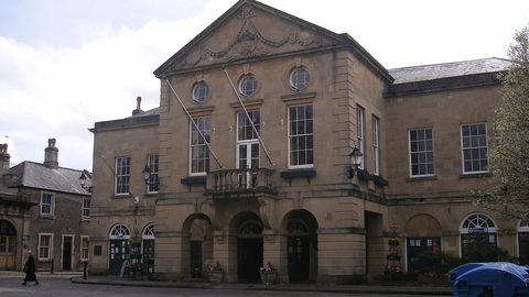 Where to Stay in the Brecon Beacons Ranked by What You Can Reach on Foot
The best base in Bannau Brycheiniog is the one where you can lace your boots and walk onto the hill. Here is every town ranked by what leaves from the door.
Where to Stay in the Brecon Beacons Ranked by What You Can Reach on Foot
The best base in Bannau Brycheiniog is the one where you can lace your boots and walk onto the hill. Here is every town ranked by what leaves from the door.
-
 Flying into Bannau Brycheiniog via Cardiff Bristol and Birmingham
Flying into Bannau Brycheiniog: how to reach the park by train and bus from Cardiff, Bristol and Birmingham airports, with taxi costs where public transport fails.
Flying into Bannau Brycheiniog via Cardiff Bristol and Birmingham
Flying into Bannau Brycheiniog: how to reach the park by train and bus from Cardiff, Bristol and Birmingham airports, with taxi costs where public transport fails.
-
 Things to Do in Bannau Brycheiniog Sorted by Whether You Have a Car
Some of Bannau Brycheiniog's finest walks begin at bus stops. Others require a taxi or a long approach on foot. Here is every major activity sorted by access.
Things to Do in Bannau Brycheiniog Sorted by Whether You Have a Car
Some of Bannau Brycheiniog's finest walks begin at bus stops. Others require a taxi or a long approach on foot. Here is every major activity sorted by access.
-
 Best Time to Visit Bannau Brycheiniog Month by Month Including Daylight Hours
August brings queues to Pen y Fan's summit, November loses the light by four, and the Royal Welsh Show swallows every bed for miles. Here is the park month by month.
Best Time to Visit Bannau Brycheiniog Month by Month Including Daylight Hours
August brings queues to Pen y Fan's summit, November loses the light by four, and the Royal Welsh Show swallows every bed for miles. Here is the park month by month.
-
 Getting Around the Brecon Beacons Without a Car: What Runs and What Does Not
No bus reaches the trailheads of Bannau Brycheiniog. Here is what the TrawsCymru network does serve, and what to do when the tarmac runs out.
Getting Around the Brecon Beacons Without a Car: What Runs and What Does Not
No bus reaches the trailheads of Bannau Brycheiniog. Here is what the TrawsCymru network does serve, and what to do when the tarmac runs out.
-
 Pen y Fan
 can be climbed from the Storey Arms bus stop on the TrawsCymru corridor, with quieter alternatives from Cwm Gwdi and a long walk-in from Brecon.
Pen y Fan
Pen y Fan can be climbed from the Storey Arms bus stop on the TrawsCymru corridor, with quieter alternatives from Cwm Gwdi and a long walk-in from Brecon.
-
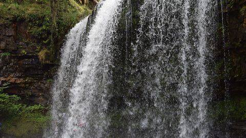 Waterfall Country
's Four Waterfalls Walk is reachable by a long road-walk from the nearest bus stop or by taxi from Abergavenny station, with slippery paths year-round.
Waterfall Country
Waterfall Country's Four Waterfalls Walk is reachable by a long road-walk from the nearest bus stop or by taxi from Abergavenny station, with slippery paths year-round.
-
 Llangorse Lake
 is a short, flat walk from the bus stop on the TrawsCymru corridor from Brecon, with a crannog, bird hides, and watersports at the water's edge.
Llangorse Lake
Llangorse Lake is a short, flat walk from the bus stop on the TrawsCymru corridor from Brecon, with a crannog, bird hides, and watersports at the water's edge.