Crickhowell: Gastropubs and Gentle Walks on the T4 Bus Corridor
Crickhowell sits on the T4 bus corridor between Brecon and Abergavenny, with a walk-up Table Mountain, a gastropub high street, and a bus in both directions.
- Flag
-

- ISO code
- GB
- Population
- 2,800
- Currency
- GBP
- Timezone
- Europe/London
Crickhowell: Gastropubs and Gentle Walks on the T4 Bus Corridor
You step off the T4 bus onto Crickhowell High Street at 10:17 on a Tuesday morning. The driver has your full attention for the exact time it takes to collect your rucksack from the luggage bay, then the coach pulls away toward Brecon and the street is yours. This is the defining rhythm of a car‑free Brecon Beacons base, and this village is the only one in the park that makes it work.
The TrawsCymru T4 runs between Cardiff and Brecon via Abergavenny, stopping in Crickhowell. The journey from the railway station takes about fifteen minutes. From Brecon it is half an hour east. That gives you a two‑way bus corridor that hits both of the park’s main rail and town hubs, something no other village in the Brecon Beacons can claim. If you want a base where you can arrive by train, leave the car behind and still walk up a mountain before lunch, this is the place. Check Traveline Cymru for live times before you travel; rural services change without warning.


The Walk from the High Street: Crug Hywel (Table Mountain)
Straight Up from the High Street
Crug Hywel, called Table Mountain in English, rises to 451 metres directly behind the town. The round trip from the high street is roughly 5 kilometres, and the path starts at the end of Heol‑Y‑Felin, a short walk from the Bear Hotel bus stop. This is a Cadw‑scheduled Iron Age hillfort, not a paved park. The ascent climbs through bracken and sheep pasture, steep enough in the final push to make you grateful for the pancake‑flat summit.
From the top you look south across the Usk Valley toward the Brecon Beacons main ridge. Pen y Fan is visible on a clear day, but Table Mountain itself is the point. The summit plateau still shows the outlines of defensive ramparts from 2,000 years ago. Allow 90 minutes up and down at a steady pace, two hours if you stop on the summit. Do not attempt this in hill fog without an offline map.
The Riverside Loop
If you have a second morning, the path along the River Usk starts behind the Bear Hotel and follows a flat, well‑trodden route toward Llangattock. It is not an adventure trail. It is a forty‑minute loop for the day you arrived or the morning you leave.
The High Street and No Chain Stores
A Street Without Multiples
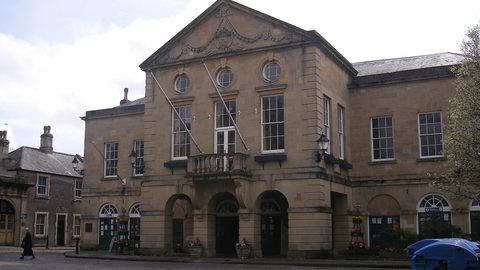
Crickhowell High Street was named in a 2005 New Economics Foundation report called Clone Town Britain as an example of a place that had resisted chain retail. A 2024 survey confirmed the figure still holds: zero percent chain stores. Every shop on the main street is independent. The Plunkett Foundation published a case study called The Crickhowell Model in 2019 examining how the town maintained this; the short answer is a long‑standing collective refusal among landlords and the community council to rent to multiples.
What this means for you as a walker is practical. You can buy dehydrated meal pouches from the outdoor shop, pick up local Monmouthshire cider from the deli, and get a packed lunch made at the bakery, all on the same street without crossing a road. The town’s conservation area designation dates from 1971, which protects the stone frontages and keeps the street readable as a Georgian market town rather than a strip of supermarket fascia.
Where to Eat After the Walk
For evening food, the Bear Hotel is a historic gastropub built into a coaching inn, a minute from the T4 stop. The menu runs to local venison burgers and Welsh lamb cawl in winter. Book a table by 16:00 on summer weekends. The alternative is the Bridge Inn by the 13‑arch stone bridge (rebuilt 1828 over a 1706 original), which does solid pub food and has a beer garden on the riverbank.
What You Cannot Reach Without Wheels
The Limits of the Bus Corridor
Be honest about the limitations. From here you can walk Table Mountain and the riverside. You can also walk the towpath of the Monmouthshire and Brecon Canal, which runs through Llangattock, a short way east along the road. But the major trailheads of the Brecon Beacons are not within walking distance of the T4 stop.
Pen y Fan from the Storey Arms lay‑by is a taxi ride from Abergavenny station, not from Crickhowell. The Four Waterfalls Walk in Waterfall Country requires a taxi from Abergavenny to the pay‑and‑display car park at Pont Melin Fach; budget roughly twenty‑five pounds each way. Llanthony Priory, the ruined Augustinian monastery with a pub in the crypt, has no bus service at all. A taxi from the station costs about thirty pounds one way. The Beacons Way, a 159‑kilometre trail from Abergavenny to Llangadog, passes through Crickhowell on Stage 1, so you can walk out of town south‑east toward Llanthony, but you are then committed to a full day on the trail with no escape route.
Plan One Objective Per Day
Do not fall for the common mistake of trying to tick Pen y Fan, the Black Mountain and the waterfalls in a single day. From a car‑free base that is impossible. Pick one objective per day and accept that you will spend some of your budget on taxis. The Sennybridge firing range closes large sections of the western park without online notice; red flags at the roadside mean no access, no exceptions.
| Route | Frequency Mon–Sat | Frequency Sunday | Journey Time From Crickhowell |
|---|---|---|---|
| Crickhowell to Abergavenny | Roughly hourly | Limited (check Traveline Cymru) | About 15 minutes |
| Crickhowell to Brecon | Roughly hourly | Limited (check Traveline Cymru) | About 30 minutes |
| Crickhowell to Cardiff | Every 2 hours | No Sunday service | 2 hours 10 minutes |


Castle, Bridge and the Walk to Tretower
The Castle and the Bridge
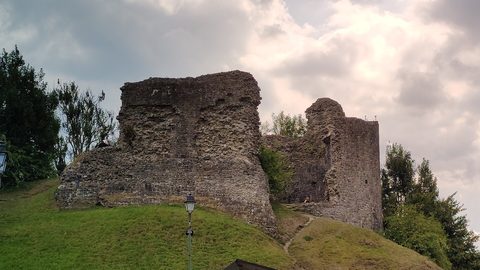
Crickhowell Castle is a Norman motte‑and‑bailey from the 12th century, a grass mound with a few fragments of stonework, right in the town centre behind the high street. It takes ten minutes to see. The bridge over the Usk is an architectural curiosity with a disputed arch count. The upstream side shows 12 arches, the downstream side shows 13. It was built in 1706 and rebuilt in 1828. Walk across it to reach the Llangattock side of the river, where the path runs underneath the limestone cliffs of Craig y Cilau National Nature Reserve.
Tretower and the Escarpment
The nearby Tretower Castle and Court, 3 kilometres north, is more substantial: a 12th‑century motte with a 13th‑century stone keep, plus a 14th‑ and 15th‑century fortified manor house. The walk out to Tretower follows the lane north through fields, about forty minutes each way on foot. The Court interior requires a booked guided tour with a Cadw entry fee. That cliff line is the Llangattock Escarpment, a Site of Special Scientific Interest with abandoned quarries and a subterranean boat trip at the Dan yr Ogof Showcaves complex, which is a family attraction with a dinosaur park attached and requires a pre‑booked slot in peak season.
Connectivity, Weather and the One Thing to Do Now
Signal and Safety
Mobile signal disappears in the valley below Table Mountain and throughout Waterfall Country. EE and Vodafone are the least patchy on high ridges. Download offline maps from OS Maps or AllTrails before you leave your accommodation. Do not rely on café Wi‑Fi at the trailhead because there often is not a café.
The weather can turn from sunshine to disorienting hill fog in twenty minutes, even in August. Carry a waterproof jacket and a map case on every walk, including the 5‑kilometre Table Mountain loop. The peaks are frequently shrouded in cloud; do not expect guaranteed views. If you have three full days in the area, allocate one for the central Beacons horseshoe via a taxi from Abergavenny, one for Waterfall Country via a taxi from Abergavenny, and keep one in reserve for the weather window that closes.
When to Come and Where to Stay
November is reliably wet, grey and short. The Royal Welsh Show in late July and the Brecon Jazz Festival in August flood every B&B and road within forty miles; avoid those weeks if you want quiet trails. Book accommodation that faces the high street, so the bus stop is your front door. The 2021 Census counted 2,063 residents in Crickhowell. On a summer Saturday that number doubles with day‑trippers, but by 17:00 the T4 takes them away and the town belongs to the people who stayed.
Open the Traveline Cymru journey planner, enter Abergavenny station as your departure point and Crickhowell High Street as your destination, and check the T4 departure for the day you arrive. That is the single most practical thing you can do. Everything else follows from the bus.
More destinations in Brecon Beacons
What to See in Crickhowell
Frequently Asked Questions
Can I reach Pen y Fan from Crickhowell by bus?
No. The T4 does not stop at the Storey Arms or any Pen y Fan trailhead. You need a taxi from Abergavenny station, about 20 minutes and 20 pounds. Alternatively, join a guided walk from Brecon that includes transport.
How do I get from Cardiff Airport to Crickhowell without a car?
Take the T9 bus from the airport to Cardiff city centre, then the T4 bus from Cardiff to Crickhowell. The full journey takes about 2 hours 45 minutes. There is no direct rail link from the airport.
Are the shops in Crickhowell open on Sundays?
Many close by 16:00 or do not open at all on Sunday. The Bear Hotel serves food all day. The T4 bus on Sunday is limited. Plan your grocery stops for Saturday afternoon at the latest.
Is Table Mountain safe in bad weather?
No. The path is steep grass and loose stone. In hill fog or high wind, the summit offers zero shelter and the route off is easy to lose. Skip it if visibility is under 100 metres and walk the riverside instead.
Read next
-
 Tretower Court and Castle
Tretower pairs a ruined castle with a fortified manor house on the T4 bus corridor. Book the guided tour inside the manor and walk from the nearest bus stop.
Tretower Court and Castle
Tretower pairs a ruined castle with a fortified manor house on the T4 bus corridor. Book the guided tour inside the manor and walk from the nearest bus stop.
-
 Brecon Beacons Hotels: Country Houses, Coaching Inns and the Festival Premium
The best hotels in Bannau Brycheiniog are those you can reach by train or bus. Here are the coaching inns and country houses with a bus stop or platform nearby.
Brecon Beacons Hotels: Country Houses, Coaching Inns and the Festival Premium
The best hotels in Bannau Brycheiniog are those you can reach by train or bus. Here are the coaching inns and country houses with a bus stop or platform nearby.
-
 Where to Stay in the Brecon Beacons Ranked by What You Can Reach on Foot
The best base in Bannau Brycheiniog is the one where you can lace your boots and walk onto the hill. Here is every town ranked by what leaves from the door.
Where to Stay in the Brecon Beacons Ranked by What You Can Reach on Foot
The best base in Bannau Brycheiniog is the one where you can lace your boots and walk onto the hill. Here is every town ranked by what leaves from the door.
-
 Flying into Bannau Brycheiniog via Cardiff Bristol and Birmingham
Flying into Bannau Brycheiniog: how to reach the park by train and bus from Cardiff, Bristol and Birmingham airports, with taxi costs where public transport fails.
Flying into Bannau Brycheiniog via Cardiff Bristol and Birmingham
Flying into Bannau Brycheiniog: how to reach the park by train and bus from Cardiff, Bristol and Birmingham airports, with taxi costs where public transport fails.
-
 Things to Do in Bannau Brycheiniog Sorted by Whether You Have a Car
Some of Bannau Brycheiniog's finest walks begin at bus stops. Others require a taxi or a long approach on foot. Here is every major activity sorted by access.
Things to Do in Bannau Brycheiniog Sorted by Whether You Have a Car
Some of Bannau Brycheiniog's finest walks begin at bus stops. Others require a taxi or a long approach on foot. Here is every major activity sorted by access.
-
 Best Time to Visit Bannau Brycheiniog Month by Month Including Daylight Hours
August brings queues to Pen y Fan's summit, November loses the light by four, and the Royal Welsh Show swallows every bed for miles. Here is the park month by month.
Best Time to Visit Bannau Brycheiniog Month by Month Including Daylight Hours
August brings queues to Pen y Fan's summit, November loses the light by four, and the Royal Welsh Show swallows every bed for miles. Here is the park month by month.
-
 Getting Around the Brecon Beacons Without a Car: What Runs and What Does Not
No bus reaches the trailheads of Bannau Brycheiniog. Here is what the TrawsCymru network does serve, and what to do when the tarmac runs out.
Getting Around the Brecon Beacons Without a Car: What Runs and What Does Not
No bus reaches the trailheads of Bannau Brycheiniog. Here is what the TrawsCymru network does serve, and what to do when the tarmac runs out.
-
 Llandovery
 railway station on the Heart of Wales line is the western railhead for the Black Mountain, with taxis to Carreg Cennen and long walk-ins for Llyn y Fan Fach.
Llandovery
Llandovery railway station on the Heart of Wales line is the western railhead for the Black Mountain, with taxis to Carreg Cennen and long walk-ins for Llyn y Fan Fach.
-
 Abergavenny
 is the rail gateway to Bannau Brycheiniog, with a mainline station, a walk-up Sugar Loaf, a foodie reputation, and the taxi rank that gets you to Pen y Fan.
Abergavenny
Abergavenny is the rail gateway to Bannau Brycheiniog, with a mainline station, a walk-up Sugar Loaf, a foodie reputation, and the taxi rank that gets you to Pen y Fan.