The Beacons Way and Offa's Dyke Path: Two Long Trails That Cross Bannau Brycheiniog
The Beacons Way crosses the roof of Bannau Brycheiniog; Offa's Dyke traces the border. We compare both long trails for walkers arriving by train, with no car.


You Have No Car. Here is the Answer.
You want to walk a long trail across Bannau Brycheiniog, the Brecon Beacons, but you do not drive. The Beacons Way or Offa's Dyke Path: which one works? Offa's Dyke Path, by a wide margin. It has railheads at both ends, bus connections through most stage endpoints, and accommodation every 10 to 15 miles. The Beacons Way is shorter at 99 miles compared to 177. But it leaves you stranded on long sections where no bus comes within walking distance. You carry a tent or you pre-book a taxi. Those are your choices.
| Factor | Beacons Way (99 Miles, 8 Days) | Offa's Dyke Path (177 Miles, 14 Days) |
|---|---|---|
| Rail start | Abergavenny, on the Manchester-Cardiff line | Chepstow, on the Cardiff-Manchester line |
| Rail finish | Llandovery, on the Heart of Wales line with a handful of trains per day | Prestatyn, on the North Wales coast line |
| Bus corridors crossing the route | Brecon-Abergavenny (roughly hourly on weekdays, less on Sundays); Brecon-Llandovery (roughly every two to three hours on weekdays, very limited Sunday) | Brecon-Hay-Hereford (roughly every two hours on weekdays); multiple others serving villages and towns along the length |
| Sections with no bus access | Central Beacons section between Llangynidr and Llandovery. Roughly 40 miles with no public transport. You must either wild camp or arrange a taxi from the nearest road access point. | None. Every stage endpoint has a village or town reachable by bus or rail. |
| Navigation | Intermittent waymarking; map and compass required across open moorland where the path is indistinct | Continuous acorn symbol and named signs; well defined trail throughout |
| Accommodation gaps | Multi day gaps between settlements on the central section; booking a B&B requires a taxi detour | Villages or towns spaced at 10 to 15 mile intervals; walkable between each |
How to Do Offa’s Dyke Without a Car
Start and End by Rail
Arrive at Abergavenny station by Transport for Wales train from Cardiff or Manchester. From there, take the Stagecoach South Wales Brecon-Abergavenny bus to connect to the trail at either Abergavenny itself (the path passes within a mile of the station) or Hay-on-Wye. The Brecon-Hay-Hereford bus, also Stagecoach, runs on weekdays with a reduced Sunday service.
At the north end, Prestatyn station puts you a short walk from the trailhead. At the south end, Chepstow station puts you directly on the path. Every overnight point in between has a bus or rail connection. You never need to wild camp unless you want to. Check Traveline Cymru for live times before you travel. Timetables shift and rural services get re-tendered without warning.
Navigation and Terrain
Navigation is straightforward. The trail is marked continuously with the acorn symbol and named signs. The proportion above 300 metres is about 25 percent, compared to 70 percent on the Beacons Way. You spend less time contouring in cloud.
Why the Beacons Way Breaks the Car Less Traveller
The Middle 40 Miles
The Beacons Way runs 99 miles from Abergavenny to Llandovery. Abergavenny station works fine as a start. Llandovery station works as a finish, but it sits on the Heart of Wales line with only a handful of trains per day. Time your final day precisely or wait hours. The real problem is the middle 40 miles.
From Llangynidr to Llandovery, no bus route touches the trail. The central Beacons section crosses high moorland at 300 metres or above for 70 percent of the route. The path itself is indistinct on several summits and plateaux. Waymarking is intermittent. Navigate by map and compass or get lost in hill fog, which can descend even in August. The Brecon Beacons is not chocolate box pretty; the weather turns fast and the beauty is stark. The lack of public transport to trailheads demands a self sufficiency that casual day trippers underestimate.
Your Two Options for the Gap
Carry a tent and wild camp. This is legal in the park with a permit from the National Park Authority. Or book a taxi from the nearest road access point to a B&B. That taxi costs roughly 30 to 50 pounds per segment and can rarely be hailed on short notice. Mobile signal vanishes in the valleys. The Black Mountain is a dead zone for EE, Vodafone, and everyone else. Download offline maps from OS Maps or AllTrails before you leave your accommodation. Do not rely on cafe Wi Fi at a trailhead. There often is not a cafe.
Worth it if
- Offa's Dyke Path: rail and bus at both ends and most overnight stops; no section requires a taxi or wild camping unless you choose it.
- Offa's Dyke Path: continuous waymarking and a well defined trail mean you navigate by following the acorn symbol, not reading contours in fog.
- Offa's Dyke Path: accommodation every 10 to 15 miles; you end each day in a village with a bed and a resupply shop.
- Beacons Way: shorter at 99 miles versus 177; doable in 8 days rather than 14 if you have limited holiday time.
Skip it if
- Beacons Way: 40 mile central section with no bus access; you must carry a tent or pre book a taxi from a dead zone with no mobile signal.
- Beacons Way: intermittent waymarking and 70 percent of the route above 300 metres means you need map and compass skills in terrain where the path is often indistinct.
- Beacons Way: Llandovery station has only a handful of trains per day; miss it and you wait hours.
- Beacons Way: resupply points are limited to Llangynidr, Crickhowell, Llandovery, and a few small villages with no guarantee of opening hours.


Who This Suits and Who it Does Not
Choose Offa's Dyke If
You arrive by train, want a bed each night, and do not want to navigate by contour lines in fog. It is the right choice for a first long distance walk in the UK or for anyone who values logistics over wilderness.
Choose the Beacons Way If
You are an experienced backpacker with a tent, a map, a compass, and the willingness to spend 40 miles without a resupply or an escape route. It suits the person who prioritises solitude over facilities and understands that the Brecon Beacons is not a city break with walkable attractions.
The single thing that most often goes wrong: a walker without a car arrives at Abergavenny station, assumes a postcode on a sat nav will take them to a trailhead, and ends up on a dead end farm track with no turning space and no signal. Plan the bus route to the trailhead before you leave home. Do not trust a sat nav to find a footpath.
Read next
-

 Brecon Beacons Hotels: Country Houses, Coaching Inns and the Festival Premium
The best hotels in Bannau Brycheiniog are those you can reach by train or bus. Here are the coaching inns and country houses with a bus stop or platform nearby.
Brecon Beacons Hotels: Country Houses, Coaching Inns and the Festival Premium
The best hotels in Bannau Brycheiniog are those you can reach by train or bus. Here are the coaching inns and country houses with a bus stop or platform nearby.
-
 Where to Stay in the Brecon Beacons Ranked by What You Can Reach on Foot
The best base in Bannau Brycheiniog is the one where you can lace your boots and walk onto the hill. Here is every town ranked by what leaves from the door.
Where to Stay in the Brecon Beacons Ranked by What You Can Reach on Foot
The best base in Bannau Brycheiniog is the one where you can lace your boots and walk onto the hill. Here is every town ranked by what leaves from the door.
-
 Flying into Bannau Brycheiniog via Cardiff Bristol and Birmingham
Flying into Bannau Brycheiniog: how to reach the park by train and bus from Cardiff, Bristol and Birmingham airports, with taxi costs where public transport fails.
Flying into Bannau Brycheiniog via Cardiff Bristol and Birmingham
Flying into Bannau Brycheiniog: how to reach the park by train and bus from Cardiff, Bristol and Birmingham airports, with taxi costs where public transport fails.
-
 Things to Do in Bannau Brycheiniog Sorted by Whether You Have a Car
Some of Bannau Brycheiniog's finest walks begin at bus stops. Others require a taxi or a long approach on foot. Here is every major activity sorted by access.
Things to Do in Bannau Brycheiniog Sorted by Whether You Have a Car
Some of Bannau Brycheiniog's finest walks begin at bus stops. Others require a taxi or a long approach on foot. Here is every major activity sorted by access.
-
 Best Time to Visit Bannau Brycheiniog Month by Month Including Daylight Hours
August brings queues to Pen y Fan's summit, November loses the light by four, and the Royal Welsh Show swallows every bed for miles. Here is the park month by month.
Best Time to Visit Bannau Brycheiniog Month by Month Including Daylight Hours
August brings queues to Pen y Fan's summit, November loses the light by four, and the Royal Welsh Show swallows every bed for miles. Here is the park month by month.
-
 Getting Around the Brecon Beacons Without a Car: What Runs and What Does Not
No bus reaches the trailheads of Bannau Brycheiniog. Here is what the TrawsCymru network does serve, and what to do when the tarmac runs out.
Getting Around the Brecon Beacons Without a Car: What Runs and What Does Not
No bus reaches the trailheads of Bannau Brycheiniog. Here is what the TrawsCymru network does serve, and what to do when the tarmac runs out.
-
 Pen y Fan
 can be climbed from the Storey Arms bus stop on the TrawsCymru corridor, with quieter alternatives from Cwm Gwdi and a long walk-in from Brecon.
Pen y Fan
Pen y Fan can be climbed from the Storey Arms bus stop on the TrawsCymru corridor, with quieter alternatives from Cwm Gwdi and a long walk-in from Brecon.
-
 Waterfall Country
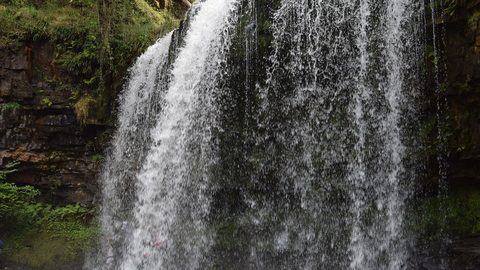
's Four Waterfalls Walk is reachable by a long road-walk from the nearest bus stop or by taxi from Abergavenny station, with slippery paths year-round.
Waterfall Country
Waterfall Country's Four Waterfalls Walk is reachable by a long road-walk from the nearest bus stop or by taxi from Abergavenny station, with slippery paths year-round.
-
 Llangorse Lake
 is a short, flat walk from the bus stop on the TrawsCymru corridor from Brecon, with a crannog, bird hides, and watersports at the water's edge.
Llangorse Lake
Llangorse Lake is a short, flat walk from the bus stop on the TrawsCymru corridor from Brecon, with a crannog, bird hides, and watersports at the water's edge.