The Beacons Bus: What It Was, What Runs Now, and What to Check Before You Travel
The seasonal Beacons Bus has come and gone. Here is what runs now on the TrawsCymru corridors, what doesn't, and why you must check Traveline Cymru before travelling.


The Beacons Bus Does Not Run in 2025 and Its Future is Uncertain Every Year
The Beacons Bus last ran a confirmed timetable in its reduced 2024 season. It has been withdrawn and revived before: launched in 2001, cancelled in 2016, revived with Welsh Government sustainable transport funding in 2022 for summer Sundays and bank holidays, then pared back in 2024. The 2025 season has no guaranteed service. If the bus runs in any future year, the announcement comes from the Bannau Brycheiniog National Park Authority and the schedule appears on Traveline Cymru. Do not plan a trip around it. Assume it is not running until you see a confirmed timetable for the exact dates of your visit.
The Year Round Bus Routes That Actually Exist
The network that connects the park's market towns is thin but predictable. The TrawsCymru T4 runs roughly hourly between Abergavenny, Brecon, and Merthyr Tydfil, operated by Stagecoach South Wales. The same route links Cardiff to Brecon via Merthyr Tydfil on a similar frequency. The TrawsCymru T14 connects Brecon to Hay-on-Wye and Hereford, though this service is less frequent, with even fewer departures on Sundays.
Beyond these corridors, frequencies drop sharply. The Brecon to Llandovery service via Sennybridge, run by Celtic Travel, makes two or three journeys a day. The Swansea to Brecon route via Ystradgynlais and Sennybridge, operated by First Cymru, is similarly sparse. The Neath to Pontneddfechan bus serves the Waterfall Country trailhead but runs only a handful of times daily. Every one of these services sees reduced Sunday timetables; some have no Sunday service at all.
The practical answer for most visitors is clear: you need a car to reach trailheads. The bus network connects towns, not peaks. You can ride the T4 from Abergavenny to Brecon, but you cannot ride a bus to Pont ar Dafydd, the Storey Arms, Ystradfellte, or Llyn y Fan Fach.
Walking Without a Car
You can manage without a car if you plan carefully and adjust your ambitions. Linear walks using railway halts as start or end points are viable. Abergavenny sits on the Transport for Wales Marches Line with roughly hourly trains to Hereford, Shrewsbury, Crewe, Manchester, Newport, and Cardiff. From Abergavenny, walk east onto the Black Mountains ridges. Llandovery, on the Heart of Wales Line, gives access to the western park and Fforest Fawr. Merthyr Tydfil, with trains every 30 minutes to Cardiff, puts the Taf Fechan reservoirs within walking distance. Ebbw Vale Town, hourly to Cardiff, opens the eastern park edge.
Circular walks from bus-served towns are your other option. Brecon, Crickhowell, Hay-on-Wye, and Llangorse all have year-round bus access and enough trails starting from their edges to fill a day. Pen y Fan and Corn Du can be reached on foot from Brecon, though it is a 90-minute walk to the summit path, or via the T4 to the Storey Arms lay-by, which drops you at the base of the main ascent route. The T4 does not stop at the lay-by on every journey; check the timetable for a request stop.
Check Traveline Cymru for live times before you travel. Rural Welsh timetables change with little notice and a planned journey can vanish between seasons.
What Does Not Run and Why You Need a Backup Plan
No bus route serves Pont ar Dafydd, the busiest Pen y Fan trailhead. No bus serves Ystradfellte, the village at the start of the Four Waterfalls Walk. No bus serves the remote car parks at Llyn y Fan Fach, Carreg Cennen Castle, or the western Black Mountain. The Beacons Bus was designed to fill exactly these gaps, and without it, those trailheads are car-only.
The failure case is simple. Arrive in Brecon by bus assuming a weekend shuttle to the hills will appear, and you will stand at the bus stance with no onward option. Two practical workarounds exist. First, pre-book a taxi from Brecon or Abergavenny to an upland start point. The one-way cost falls between £15 and £30. Smartphone signal is unreliable in the park, so book before you travel, not from the trailhead. Second, accept that you are walking from a town or railway halt, which adds two to four hours round-trip to your day.
Why the Network Is So Thin
The wider problem is structural. Welsh bus services outside major corridors are deregulated commercial operations with no statutory minimum provision. The Welsh Government provides a Bus Services Support Grant to local authorities for socially necessary routes, but funding levels are set annually and have declined in real terms since 2010. Powys, the county covering most of the park, has a population density below 25 people per square kilometre. Driver shortages after 2020 and rising operating costs have accelerated cuts. The Beacons Bus itself is a stop-gap, funded year-by-year, never a permanent network. Plan accordingly.


| Route | Operator | Frequency (Weekday) | Key Stops |
|---|---|---|---|
| TrawsCymru T4 | Stagecoach South Wales | Roughly hourly | Cardiff, Merthyr Tydfil, Brecon, Abergavenny |
| TrawsCymru T14 | Stagecoach South Wales | Roughly every 2 hours | Brecon, Talgarth, Hay-on-Wye, Hereford |
| Brecon to Llandovery | Celtic Travel | 2-3 journeys per day | Brecon, Sennybridge, Llandovery |
| Swansea to Brecon | First Cymru | 3-4 journeys per day | Swansea, Ystradgynlais, Sennybridge, Brecon |
| Neath to Pontneddfechan | First Cymru | 4-5 journeys per day | Neath, Glynneath, Pontneddfechan |
| Abergavenny to Hereford | Stagecoach South Wales | 3-4 journeys per day | Abergavenny, Pontrilas, Hereford |
| Llandeilo to Brecon | Celtic Travel | 2 journeys per day | Llandeilo, Llangadog, Brecon |
How to Check Before You Go and the One Thing That Trips Visitors Up
Before every trip, open Traveline Cymru and enter the exact date and time you plan to travel. Do not rely on Google Maps or any third-party app for rural Welsh bus times; they aggregate data inconsistently and miss request stops. Download offline maps for the whole park using OS Maps or AllTrails while you have Wi-Fi at your accommodation. Mobile signal vanishes in Waterfall Country, the Black Mountain, and most valleys. EE and Vodafone offer the least patchy 4G over high ridges, but do not count on it.
The single most common mistake visitors make is assuming a sat-nav postcode for a trailhead car park will work. Postcodes in Bannau Brycheiniog often cover a farm or a valley, not the car park entrance itself. The result is a dead-end farm track with no turning space and no phone signal to call for help. Use What3Words or precise grid coordinates for any car park, and check the National Park Authority website for current access notes before you drive.
If you hire a taxi pre-booked from a town, agree the fare and the exact drop-off point in advance. Drivers will not wait at trailheads, so budget for a return taxi at a set time or accept the walk back to town. The cost for a one-way trip from Brecon or Abergavenny to the Storey Arms or Pont ar Dafydd falls between £15 and £30.
Read next
-

 Brecon Beacons Hotels: Country Houses, Coaching Inns and the Festival Premium
The best hotels in Bannau Brycheiniog are those you can reach by train or bus. Here are the coaching inns and country houses with a bus stop or platform nearby.
Brecon Beacons Hotels: Country Houses, Coaching Inns and the Festival Premium
The best hotels in Bannau Brycheiniog are those you can reach by train or bus. Here are the coaching inns and country houses with a bus stop or platform nearby.
-
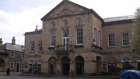 Where to Stay in the Brecon Beacons Ranked by What You Can Reach on Foot
The best base in Bannau Brycheiniog is the one where you can lace your boots and walk onto the hill. Here is every town ranked by what leaves from the door.
Where to Stay in the Brecon Beacons Ranked by What You Can Reach on Foot
The best base in Bannau Brycheiniog is the one where you can lace your boots and walk onto the hill. Here is every town ranked by what leaves from the door.
-
 Flying into Bannau Brycheiniog via Cardiff Bristol and Birmingham
Flying into Bannau Brycheiniog: how to reach the park by train and bus from Cardiff, Bristol and Birmingham airports, with taxi costs where public transport fails.
Flying into Bannau Brycheiniog via Cardiff Bristol and Birmingham
Flying into Bannau Brycheiniog: how to reach the park by train and bus from Cardiff, Bristol and Birmingham airports, with taxi costs where public transport fails.
-
 Things to Do in Bannau Brycheiniog Sorted by Whether You Have a Car
Some of Bannau Brycheiniog's finest walks begin at bus stops. Others require a taxi or a long approach on foot. Here is every major activity sorted by access.
Things to Do in Bannau Brycheiniog Sorted by Whether You Have a Car
Some of Bannau Brycheiniog's finest walks begin at bus stops. Others require a taxi or a long approach on foot. Here is every major activity sorted by access.
-
 Best Time to Visit Bannau Brycheiniog Month by Month Including Daylight Hours
August brings queues to Pen y Fan's summit, November loses the light by four, and the Royal Welsh Show swallows every bed for miles. Here is the park month by month.
Best Time to Visit Bannau Brycheiniog Month by Month Including Daylight Hours
August brings queues to Pen y Fan's summit, November loses the light by four, and the Royal Welsh Show swallows every bed for miles. Here is the park month by month.
-
 Getting Around the Brecon Beacons Without a Car: What Runs and What Does Not
No bus reaches the trailheads of Bannau Brycheiniog. Here is what the TrawsCymru network does serve, and what to do when the tarmac runs out.
Getting Around the Brecon Beacons Without a Car: What Runs and What Does Not
No bus reaches the trailheads of Bannau Brycheiniog. Here is what the TrawsCymru network does serve, and what to do when the tarmac runs out.
-
 Pen y Fan
 can be climbed from the Storey Arms bus stop on the TrawsCymru corridor, with quieter alternatives from Cwm Gwdi and a long walk-in from Brecon.
Pen y Fan
Pen y Fan can be climbed from the Storey Arms bus stop on the TrawsCymru corridor, with quieter alternatives from Cwm Gwdi and a long walk-in from Brecon.
-
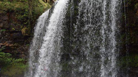 Waterfall Country
's Four Waterfalls Walk is reachable by a long road-walk from the nearest bus stop or by taxi from Abergavenny station, with slippery paths year-round.
Waterfall Country
Waterfall Country's Four Waterfalls Walk is reachable by a long road-walk from the nearest bus stop or by taxi from Abergavenny station, with slippery paths year-round.
-
 Llangorse Lake
 is a short, flat walk from the bus stop on the TrawsCymru corridor from Brecon, with a crannog, bird hides, and watersports at the water's edge.
Llangorse Lake
Llangorse Lake is a short, flat walk from the bus stop on the TrawsCymru corridor from Brecon, with a crannog, bird hides, and watersports at the water's edge.