Walking and Cycling the Monmouthshire and Brecon Canal Without a Car
How to walk or cycle the Monmouthshire and Brecon Canal towpath as a flat, traffic-free spine through Bannau Brycheiniog, with every access point linked to a bus stop or railway station.


You Arrive Without a Car and Need a Flat, Traffic-Free Route Across the Brecon Beacons
The Monmouthshire and Brecon Canal towpath is your traffic‑free spine. Thirty‑five flat miles of compacted gravel and earth connect Brecon to Pontypool, and you can reach every section by public transport. This is not a scenic loop. It is a there‑and‑back proposition unless you use the bus to make a linear day of it. The canal’s Welsh name is Camlas Sir Fynwy a Brycheiniog, and the park it crosses is Bannau Brycheiniog.
How to Reach the Towpath by Bus or Train
Brecon bus station sits a five‑minute walk from Brecon Basin, the canal’s northern terminus. The T4 runs roughly hourly through the day between Brecon and Abergavenny and stops within walking distance of every viable access point. Check Traveline Cymru for live times before you travel; Welsh rural services are cut and re‑tendered constantly.
For Talybont‑on‑Usk, get off at the T4 stop on the A40 and walk five minutes east to the towpath. For the Llangynidr Locks flight of five locks, the T4 stop is a ten‑minute walk down the village lane. At the southern end, the canal meets the railway at Abergavenny station. Take a T4 bus from there to Pontypool; Goytre Wharf is then a 15‑minute walk. The rail operator is Transport for Wales, with trains on the Manchester to Cardiff line. Do not try to reach the towpath by taxi from Abergavenny station unless you have pre‑booked. The rank is small and waits are long on summer weekends.
Section by Section: Distances, Surface, and What is Open
Brecon to Brynich (2 miles)
Firm and well‑drained compacted gravel. Brynich Aqueduct carries the canal over the River Usk. This is the best section for wheelchairs and road bikes. Two pubs sit directly on the towpath: The George near the locks (a 15‑minute walk from the flight) and The White Hart at Talybont‑on‑Usk. Dragonfly Cruises operates day‑trip boats from Brecon Basin in season.Brynich to the Locks (6 miles)
The surface turns muddy in wooded sections after rain. Wheelchair users should stop at Brynich and turn back. The Llangynidr Locks are the only lock flight on the canal, five chambers in sequence. The Crannog at Llangorse Lake is a ten‑minute detour from the towpath near the village, a reconstructed Iron Age dwelling with a small fee.Llangynidr to Gilwern (7 miles)
Muddy and sometimes impassable for narrow tyres after sustained rain. The Ashford Tunnel, 375 yards long, requires a torch and a bell; the towpath disappears inside, and you must walk or cycle on the surface that runs through the tunnel. In wet weather, divert to the road above via Gilwern village.Gilwern to Govilon (3 miles)
Firm and well‑drained again through Govilon. The Brinore Tramroad (also called the Bryn Oer Tramroad) crosses the canal here, a historic route built to carry coal and limestone from the industrial valleys.Govilon to Pontypool (10 miles)
Goytre Wharf has a boat‑hire base and day‑trip boat operations. The surface is mixed: firm in open sections, muddy under tree cover. Take the T4 bus from Abergavenny to Pontypool and get off at the wharf entrance.The Failure Case: What You Do When a Section is Closed or the Weather Turns
The towpath is not maintained in winter. After heavy rain, the muddy sections between Llangynidr and Gilwern become impassable for bikes and difficult for walkers. If you hit that stretch and cannot proceed, walk up to the A40 at Gilwern, which has a T4 bus stop. If the bus has stopped running (last departure from Brecon roughly early evening, earlier on Sundays), call a taxi from Abergavenny. Save a local taxi number before you leave signal. Mobile service dies in the wooded canal cuts, especially around Ashford Tunnel and the locks. Download offline maps from OS Maps or AllTrails before you leave your accommodation. The towpath has no café at any access point except Brecon Basin and Goytre Wharf. Bring food and water for the full distance you plan to cover.


Read next
-

 Brecon Beacons Hotels: Country Houses, Coaching Inns and the Festival Premium
The best hotels in Bannau Brycheiniog are those you can reach by train or bus. Here are the coaching inns and country houses with a bus stop or platform nearby.
Brecon Beacons Hotels: Country Houses, Coaching Inns and the Festival Premium
The best hotels in Bannau Brycheiniog are those you can reach by train or bus. Here are the coaching inns and country houses with a bus stop or platform nearby.
-
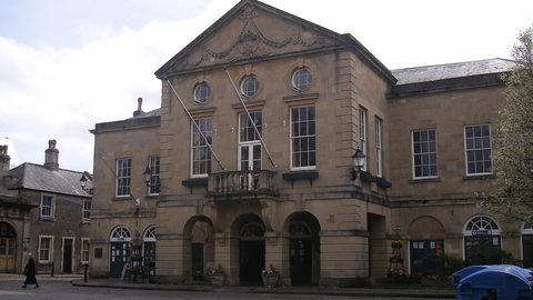 Where to Stay in the Brecon Beacons Ranked by What You Can Reach on Foot
The best base in Bannau Brycheiniog is the one where you can lace your boots and walk onto the hill. Here is every town ranked by what leaves from the door.
Where to Stay in the Brecon Beacons Ranked by What You Can Reach on Foot
The best base in Bannau Brycheiniog is the one where you can lace your boots and walk onto the hill. Here is every town ranked by what leaves from the door.
-
 Flying into Bannau Brycheiniog via Cardiff Bristol and Birmingham
Flying into Bannau Brycheiniog: how to reach the park by train and bus from Cardiff, Bristol and Birmingham airports, with taxi costs where public transport fails.
Flying into Bannau Brycheiniog via Cardiff Bristol and Birmingham
Flying into Bannau Brycheiniog: how to reach the park by train and bus from Cardiff, Bristol and Birmingham airports, with taxi costs where public transport fails.
-
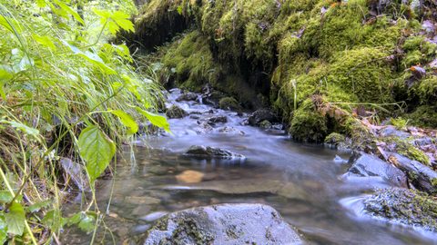 Things to Do in Bannau Brycheiniog Sorted by Whether You Have a Car
Some of Bannau Brycheiniog's finest walks begin at bus stops. Others require a taxi or a long approach on foot. Here is every major activity sorted by access.
Things to Do in Bannau Brycheiniog Sorted by Whether You Have a Car
Some of Bannau Brycheiniog's finest walks begin at bus stops. Others require a taxi or a long approach on foot. Here is every major activity sorted by access.
-
 Best Time to Visit Bannau Brycheiniog Month by Month Including Daylight Hours
August brings queues to Pen y Fan's summit, November loses the light by four, and the Royal Welsh Show swallows every bed for miles. Here is the park month by month.
Best Time to Visit Bannau Brycheiniog Month by Month Including Daylight Hours
August brings queues to Pen y Fan's summit, November loses the light by four, and the Royal Welsh Show swallows every bed for miles. Here is the park month by month.
-
 Getting Around the Brecon Beacons Without a Car: What Runs and What Does Not
No bus reaches the trailheads of Bannau Brycheiniog. Here is what the TrawsCymru network does serve, and what to do when the tarmac runs out.
Getting Around the Brecon Beacons Without a Car: What Runs and What Does Not
No bus reaches the trailheads of Bannau Brycheiniog. Here is what the TrawsCymru network does serve, and what to do when the tarmac runs out.
-
 Pen y Fan
 can be climbed from the Storey Arms bus stop on the TrawsCymru corridor, with quieter alternatives from Cwm Gwdi and a long walk-in from Brecon.
Pen y Fan
Pen y Fan can be climbed from the Storey Arms bus stop on the TrawsCymru corridor, with quieter alternatives from Cwm Gwdi and a long walk-in from Brecon.
-
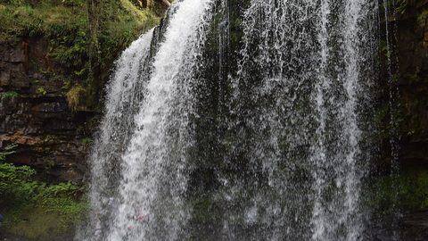 Waterfall Country
's Four Waterfalls Walk is reachable by a long road-walk from the nearest bus stop or by taxi from Abergavenny station, with slippery paths year-round.
Waterfall Country
Waterfall Country's Four Waterfalls Walk is reachable by a long road-walk from the nearest bus stop or by taxi from Abergavenny station, with slippery paths year-round.
-
 Llangorse Lake
 is a short, flat walk from the bus stop on the TrawsCymru corridor from Brecon, with a crannog, bird hides, and watersports at the water's edge.
Llangorse Lake
Llangorse Lake is a short, flat walk from the bus stop on the TrawsCymru corridor from Brecon, with a crannog, bird hides, and watersports at the water's edge.