Staying Safe on the Hills of Bannau Brycheiniog
The specific mountain hazards in Bannau Brycheiniog that catch walkers out, from Pen y Fan summit fog to Waterfall Country's slick gorges, and how to prepare without a car.


What Actually Goes Wrong on These Hills
The Brecon Beacons are not dangerous. The danger feels like a sunny afternoon until you are standing on a wet stone slab above a gorge with the water rising, or on a featureless summit plateau with the cloud down at 20 metres and no idea which way the path went. The specific incidents that keep the volunteer mountain rescue teams busy every year cluster at five locations. Learn them before you pick a walk.
The Five Places Where Incidents Cluster
The North Face Of Pen Y Fan In Ice
The summit of Pen y Fan at 886 metres is the highest point in southern Britain, but it is not the summit that causes the injuries. It is the north face, a steep grass-and-scree slope that funnels into Cwm Llwch. When that grass freezes, which can happen any month from November to April and occasionally in a cold snap in June, the slope becomes a slide. Walkers without crampons and an ice axe who attempt the direct line from the Storey Arms car park via the old Roman road have no way to stop a slip. The safe approach on a winter day is to use the less steep pony track from Pont ar Dafydd, which stays on the ridgeline. The day you skip the ice gear and decide to do it anyway is the day the mountain rescue team logs another call.
The Slippery Stone Pitches Of The Four Waterfalls Walk
The Four Waterfalls Walk is a circular gorge route of roughly 5 kilometres near Ystradfellte. The path crosses the river on stone pitches that are constantly wet from spray. In low water these pitches are a damp scramble. After a day of rain, which is most days, they are polished glass covered in a film of green algae. The hazard is not the drop, which is fatal, but the instinct to catch yourself with a hand on a wet rock when your feet go. Slips on this path are the single most common incident type in the callout records. Walk behind the curtain of Sgwd yr Eira and you will be showered. The stone floor under that waterfall is slick. Take your time. Use two hands on the chain where it is installed. Do not carry a camera in your hand.
The Disorienting Flat Moorland Of The Black Mountain In Fog
The Black Mountain in the west of the park is not a single peak. It is a high plateau of featureless moorland, cut by streams that all look the same. The paths are faint, sometimes just a worn line in the peat. When the cloud drops, which it does without warning, the plateau becomes a grey room with no walls. Walkers who set off for Llyn y Fan Fach from the car park at the end of the single-track road from Llanddeusant and do not carry a paper map and a compass on this plateau have a 30 to 40 minute window before disorientation sets in. The classic error is to descend into the wrong valley and end up miles from your start point, at dusk, with a phone that has no signal. The plateau has no café. It has no mobile tower. It has sheep and the wind.
The MOD Sennybridge Range Boundary
The Ministry of Defence uses a large area of the western Brecon Beacons as a live firing range. The boundary is marked by red flags and occasional warning signs. The red flags mean people shoot guns on the other side. Walkers who see no flags but find a gate with a MOD notice and proceed anyway because the ground looks empty are walking into a live range. The range is active most weekdays and some weekends. Check the Sennybridge firing times by calling the MOD range office before you drive west. If you arrive and see a red flag, do not enter. The walk planned for that direction is cancelled. Turn around and walk south on the open access land instead.
The Valleys Where Mobile Signal Vanishes
EE and Vodafone offer 4G on some of the high ridges, but Waterfall Country and the entire Black Mountain are dead zones. The valleys block the signal completely. Download offline maps using OS Maps or AllTrails before you leave your accommodation in Brecon or Abergavenny. Do not plan to grab the map at the trailhead. There is no café WiFi at the trailhead. Storey Arms is a lay by on the A470 with no building. Pont ar Dafydd is a gravel car park. Ystradfellte has a phone box and nothing else. The reader who leaves it to the last minute, finds there is no signal to download the map, and then walks anyway is the reader who makes the call that takes three hours.
Public Transport Access to the Hills
If you do not have a car, the bus network connects towns, not trailheads. The TrawsCymru T4 bus runs roughly hourly between Merthyr Tydfil and Brecon via the A470, but the only point at which it stops near a hill is the Storey Arms bus stop on the main road. From that stop you can walk directly onto the Pen y Fan horseshoe. The T14 bus connects Brecon and Abergavenny, but that route stays on the valley floor and does not approach any summit. For the Sugar Loaf near Abergavenny, walk from Abergavenny station, which is on the Newport-Hereford line served by Transport for Wales roughly hourly. The walk from the station to the Sugar Loaf base takes about 50 minutes along the road. For Llyn y Fan Fach, there is no bus. The only access is a taxi from Llandovery or Brecon, which costs roughly £30 to £40 one way. Check Traveline Cymru for live times before you travel. The failure case: your walk overruns daylight and you miss the last bus, which on Sundays can be as early as 16:00. Budget for a taxi recovery before you set out.
What the Minimum Kit Looks Like
You need a waterproof jacket and trousers, warm midlayers, a hat and gloves, a head torch with spare batteries, food and water for the full day, a first aid kit, and a survival bag. That list applies every month of the year. Hypothermia does not require winter. It requires wet, wind, and someone standing still for 20 minutes. That is exactly what happens when a navigational error stops the group. The two items most often left at the accommodation are the map and the compass. A phone with offline maps is a backup, not a primary. A phone battery dies in cold air in about an hour of GPS use. A paper map and a compass do not rely on battery or signal. The Ordnance Survey Explorer sheet for the central Beacons is OL12. For the eastern Beacons it is OL13. Buy both at the newsagent in Brecon town centre before you travel.
When to Go and When to Stay in Town
April to September offers long daylight hours and a better chance of settled weather. But even in July, the summit of Pen y Fan can have cloud, wind, and visibility under 50 metres. The busiest periods are the school Easter holidays and the August weeks around the Royal Welsh Show, which floods accommodation within a 40 mile radius. The Brecon Jazz Festival weekend in August fills the pubs and the roads. November is reliably grey, wet, and short on daylight before proper winter snow arrives. Minimum days for a meaningful trip is three: one for the central Beacons horseshoe, one for Waterfall Country, and one for the Black Mountain. That plan assumes you get three days of walkable weather. If day two is a blanket of fog, you accept it and stay low on the Monmouthshire and Brecon Canal towpath from Brecon.

.jpg)
The Single Thing That Most Often Goes Wrong
Visitors underestimate the distance between the three main mountain ranges and try to tick off Pen y Fan, the Black Mountain, and the waterfalls in a single day. They spend more time driving between the trailheads than they do walking. The Brecon Beacons is not a compact national park. The Black Mountain is 40 kilometres west of Pen y Fan. Waterfall Country is 20 kilometres south. A day that tries to do all three is a day of six hours in a car, two hours of rushed walking, and a missed last bus. Pick one valley per day. Walk it properly. Let the others wait for the next visit.
| Route | Trailhead | Frequency | Last Bus | Backup |
|---|---|---|---|---|
| T4 bus (Brecon-Merthyr Tydfil) | Storey Arms (Pen y Fan) | Hourly daytime | 18:30 summer | Taxi from Brecon, £25-35 |
| Walk from Abergavenny station | Sugar Loaf base | Hourly trains to Abergavenny | 21:00 trains | Taxi from Abergavenny, £15-20 |
| T14 bus (Brecon-Abergavenny) | None. Stays in valley | Every 2 hours | 17:00 Sunday | Taxi, £40-50 cross park |
| Taxi only | Llyn y Fan Fach | No bus | No bus | Pre-book taxi from Llandovery, £30-40 |
Read next
-

 Brecon Beacons Hotels: Country Houses, Coaching Inns and the Festival Premium
The best hotels in Bannau Brycheiniog are those you can reach by train or bus. Here are the coaching inns and country houses with a bus stop or platform nearby.
Brecon Beacons Hotels: Country Houses, Coaching Inns and the Festival Premium
The best hotels in Bannau Brycheiniog are those you can reach by train or bus. Here are the coaching inns and country houses with a bus stop or platform nearby.
-
 Where to Stay in the Brecon Beacons Ranked by What You Can Reach on Foot
The best base in Bannau Brycheiniog is the one where you can lace your boots and walk onto the hill. Here is every town ranked by what leaves from the door.
Where to Stay in the Brecon Beacons Ranked by What You Can Reach on Foot
The best base in Bannau Brycheiniog is the one where you can lace your boots and walk onto the hill. Here is every town ranked by what leaves from the door.
-
 Flying into Bannau Brycheiniog via Cardiff Bristol and Birmingham
Flying into Bannau Brycheiniog: how to reach the park by train and bus from Cardiff, Bristol and Birmingham airports, with taxi costs where public transport fails.
Flying into Bannau Brycheiniog via Cardiff Bristol and Birmingham
Flying into Bannau Brycheiniog: how to reach the park by train and bus from Cardiff, Bristol and Birmingham airports, with taxi costs where public transport fails.
-
 Things to Do in Bannau Brycheiniog Sorted by Whether You Have a Car
Some of Bannau Brycheiniog's finest walks begin at bus stops. Others require a taxi or a long approach on foot. Here is every major activity sorted by access.
Things to Do in Bannau Brycheiniog Sorted by Whether You Have a Car
Some of Bannau Brycheiniog's finest walks begin at bus stops. Others require a taxi or a long approach on foot. Here is every major activity sorted by access.
-
 Best Time to Visit Bannau Brycheiniog Month by Month Including Daylight Hours
August brings queues to Pen y Fan's summit, November loses the light by four, and the Royal Welsh Show swallows every bed for miles. Here is the park month by month.
Best Time to Visit Bannau Brycheiniog Month by Month Including Daylight Hours
August brings queues to Pen y Fan's summit, November loses the light by four, and the Royal Welsh Show swallows every bed for miles. Here is the park month by month.
-
 Getting Around the Brecon Beacons Without a Car: What Runs and What Does Not
No bus reaches the trailheads of Bannau Brycheiniog. Here is what the TrawsCymru network does serve, and what to do when the tarmac runs out.
Getting Around the Brecon Beacons Without a Car: What Runs and What Does Not
No bus reaches the trailheads of Bannau Brycheiniog. Here is what the TrawsCymru network does serve, and what to do when the tarmac runs out.
-
 Pen y Fan
 can be climbed from the Storey Arms bus stop on the TrawsCymru corridor, with quieter alternatives from Cwm Gwdi and a long walk-in from Brecon.
Pen y Fan
Pen y Fan can be climbed from the Storey Arms bus stop on the TrawsCymru corridor, with quieter alternatives from Cwm Gwdi and a long walk-in from Brecon.
-
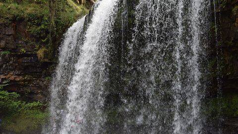 Waterfall Country
's Four Waterfalls Walk is reachable by a long road-walk from the nearest bus stop or by taxi from Abergavenny station, with slippery paths year-round.
Waterfall Country
Waterfall Country's Four Waterfalls Walk is reachable by a long road-walk from the nearest bus stop or by taxi from Abergavenny station, with slippery paths year-round.
-
 Llangorse Lake
 is a short, flat walk from the bus stop on the TrawsCymru corridor from Brecon, with a crannog, bird hides, and watersports at the water's edge.
Llangorse Lake
Llangorse Lake is a short, flat walk from the bus stop on the TrawsCymru corridor from Brecon, with a crannog, bird hides, and watersports at the water's edge.