Welsh Words on the Bannau Brycheiniog Map and What They Tell You
What the Welsh words on the Bannau Brycheiniog map really mean—from bannau and cwm to sgwd and blaen—and how they describe the ground before you set foot on it.


Welsh Words on the Bannau Brycheiniog Map and What They Tell You
Most visitors assume the Brecon Beacons is just a name, a label for a line on a hill. It is not. The Welsh name Bannau Brycheiniog means "peaks of the kingdom of Brychan." Every second word on the Ordnance Survey map is a precise description of the ground beneath your boots. Learn a dozen words and you can read the terrain before you arrive, pick a route that matches your fitness, and avoid the mistake of trying to walk up something the map already told you was a near-vertical cwm. English lacks the vocabulary for what Welsh packs into a single syllable.
Bilingual signage policy is not uniform. Welsh Government trunk-road signs place Welsh above English. Bannau Brycheiniog National Park welcome signs put English above Welsh. The National Park's legal name since April 2023 is Bannau Brycheiniog National Park, though the English name Brecon Beacons National Park is retained in law for dual naming. You will encounter both. Use the Welsh forms when asking locals for directions; it signals competence and gets you a better answer.
This is a glossary of the words you will see repeated across the map. Each entry ties the word to a specific landmark you can reach without a car, using the bus corridors or train stations that serve the park. The bus operator is Stagecoach South Wales. The TrawsCymru T4 runs Cardiff to Brecon roughly hourly on its core section, less often beyond Brecon. The T6 runs Swansea to Brecon roughly hourly. The T14 runs Hereford to Brecon via Hay-on-Wye roughly two-hourly. The nearest railway stations (all without direct bus transfer to trailheads, so budget for a taxi) are Abergavenny on the Transport for Wales Manchester to Cardiff line, Merthyr Tydfil on the Merthyr line from Cardiff, Llandovery on the Heart of Wales line, and Neath on the South Wales Main Line. A taxi from Abergavenny to the central Beacons trailheads costs roughly £20 to £30. Plan your walk around a bus or train terminus; walking into the interior from a station is a full day on its own. Check Traveline Cymru for live times before you travel; rural services change with little notice.
Summits, Heads and Horns: the High Ground
Peaks and Points
Bannau (BAN-aye) means peaks or summits, the plural of ban. Fan (van) is the mutated form of ban, meaning a single peak. Pen (pen) means head, top or end, used for the highest summit of a ridge. Corn (korn) is a horn, a sharp pointed peak. These four words describe almost every high point in the park.
Pen y Fan is the highest peak in southern Britain. The summit is a head (pen) of a top (fan). You will share it with a queue even on a Tuesday in July. Arrive at the Storey Arms trailhead by 08:30 or the Pont ar Dafydd lay-by will be full and verges will earn you a fine. The Storey Arms is on the T4 bus route; you can request the driver to stop at the lay-by, but confirm this with the driver as you board. From Abergavenny station, a taxi to the Storey Arms costs roughly £25.
Corn Du and the Dark Horn
Corn Du (korn dee) is the dark horn, Pen y Fan's quieter twin. The Bronze Age cairn on its summit is better preserved and crowds are one-tenth the size. Walk the ridge from Pen y Fan east and you will have the summit to yourself on all but August weekends. From the Storey Arms trailhead, the round-trip to both peaks takes 3 to 4 hours.
Du (dee) means black. It appears on Carreg Cennen Castle, a cliff-top ruin that requires a CADW entry fee of roughly £8. From Llandovery station, a taxi takes 15 minutes and costs around £20. The castle sits on a black rock (carreg ddu) above a limestone gorge. The word tells you the cliff is dark limestone, not the pale sandstone of the central Beacons. The footing is drier and the grip better on the rock, but the path to the castle is a steady climb.
Valleys, Water and Wood: Reading the Low Ground
Valleys and Lakes
Cwm (koom) is a valley, usually a glaciated valley head with a steep back wall. When you see cwm on the map, expect a U-shaped bowl with a stream at the bottom and very steep sides. Blaen y Glyn (bline uh glin) is the head of a wooded valley. Blaen means head of a valley or source of a river. Glyn is a deep wooded valley. The name tells you the walk starts in trees and climbs to open moorland. The T4 bus drops you at Blaen y Glyn car park, 10 minutes south of Brecon, on request. The car park fills by 09:00 in summer.
Llyn (hlin) is a lake. Llyn y Fan Fach (hlin uh van vach) is the lake of the small peak. The Lady of the Lake legend lives here. From Llandovery station, a taxi takes 25 minutes and costs roughly £35. The walk to the lake from the parking area takes 90 minutes each way on a gravel track that is wet even in dry weather. The llyn sits at the base of a cliff. If fog rolls in, the edge is invisible. Do not walk this route without offline maps downloaded; mobile signal vanishes here.
Rivers and Waterfalls
Afon (AH-von) is a river. Nant (nant) is a stream or brook. Sgwd (skood) is a waterfall or cascade. Sgwd yr Eira (skood uhr AY-ra) is the waterfall of snow, the only one you can walk behind. The Four Waterfalls Walk in Waterfall Country is a circular route, pay and display car park cost £5. From Neath station, the cheapest option is a taxi to the car park, 15 minutes and roughly £18. The path is slippery even in dry weather; the spray from Sgwd yr Eira coats the rock in a film of water and algae. Walking behind the curtain is possible but do not stop; the force of the water at full flow in April or after rain can knock you off your feet.
Fforest (FOH-rest) on a Welsh map does not mean a dense forest of trees. It means an open hunting ground, usually moorland with scattered scrub. Fforest Fawr (foh-rest vowr) is the great hunting ground, the Geopark's central plateau of limestone pavements and hidden caves. The ground is dry underfoot and the walking is easy on the old drovers' tracks, but there is no tree cover for shelter. Carry windproof layers even in August.
Pronunciation: Three Sounds That Matter
The failure case is that you cannot ask for directions because you mispronounce the name and a local does not recognise what you said. Three Welsh consonants are not in English. Ll (as in Llyn) is a voiceless lateral fricative. Place your tongue behind your front teeth and blow air around the sides. It sounds like an L with static. Dd (as in Du) is pronounced like the th in the English word "this." Ch (as in Brycheiniog) is the guttural ch in Scottish loch or German Bach. W in Welsh is a vowel, pronounced like the oo in book. Y in the final syllable of a word is pronounced like the ee in see. In non-final syllables, y is pronounced like the u in sofa. Practice at home, not in a queue at the cafe.
| Welsh Word | Pronunciation Guide | English Meaning | Landmark Example | Access From Rail Or Bus |
|---|---|---|---|---|
| Pen y Fan | pen uh van | head of the peak | Highest summit in southern Britain | T4 bus to Storey Arms lay-by; taxi from Abergavenny |
| Corn Du | korn dee | dark horn | Quieter twin peak, Bronze Age cairn | Same as Pen y Fan, walk east along ridge |
| Cwm | koom | glaciated valley | Cwm Llwch, valley below Corn Du | Walk from Brecon town 45 mins |
| Llyn y Fan Fach | hlin uh van vach | lake of the small peak | Glacial lake, Lady of the Lake legend | Taxi from Llandovery 25 mins |
| Sgwd yr Eira | skood uhr AY-ra | waterfall of snow | Walkable behind the water curtain | Taxi from Neath 15 mins to Four Waterfalls car park |
| Bannau Brycheiniog | BAN-aye bruh-KAYN-yog | peaks of Brychan's kingdom | National Park legal name since 2023 | Applies to whole park |
| Fforest Fawr | FOH-rest vowr | great hunting ground | Geopark, limestone plateau, open moorland | T4 bus to Brecon, then walk 2 hours |
| Carreg Cennen | KAH-reg KEN-en | rock of Cennen | Cliff-top castle, CADW entry fee | Taxi from Llandovery 15 mins |
| Blaen y Glyn | bline uh glin | head of the wooded valley | Trailhead for central Beacons walks | T4 bus request stop, 10 mins south of Brecon |
| Aber | AH-ber | river mouth or confluence | Abergavenny (mouth of the river Gavenny) | Transport for Wales Manchester to Cardiff line |

_-_OS_One_inch_map_1898_darker.jpg)
Rock, Cave and Pass: the Hidden Terrain
Carreg (KAH-reg) is a rock or crag. Craig (kraig) is the same word, a rock face. When you see carreg on the map, expect limestone with sharp edges that cut boots. The path to Carreg Cennen Castle from the car park is 1.5 kilometres and gains elevation on exposed bedrock. Ogof (OH-gof) is a cave. Dan-yr-Ogof (dan ur OH-gof) is the show cave complex with a commercial dinosaur park attached. The National Showcaves Centre is family-focused and requires pre-booking for peak summer. From Brecon, the T6 bus stops 1 kilometre from the entrance; walk from the Tafarn y Garreg stop.
Bwlch (boolkh) is a pass or gap. It tells you where to cross between valleys without climbing over a peak. Bwlch y Ddwyallt is the pass of the two wooded hills, a route used by drovers for centuries. The T4 bus drops you at the pass road junction, 15 minutes south of Brecon. The walk through the pass is 3 kilometres on a gravel track that stays dry in all but the heaviest rain.
Church, Wood and Stream: Settlements That Named Themselves
Reading the Village Names
Llan (hlan) is a church enclosure or a settlement with a church. Llanthony Priory is a ruined Augustinian priory with a pub in the crypt. From Abergavenny station, the taxi costs roughly £30. The priory sits in the Vale of Ewyas, a valley that is north-south oriented and traps cloud. Arrive before 11:00 in summer for clear light, or accept that the valley will be grey by 14:00. Coed (koyd) is wood or forest. Coed y Brenin is the king's forest, but there is no trail here; the name appears on older maps of the park's eastern edge.
Learn the Words Before You Pack
The single thing that most often goes wrong is that a visitor reads "Blaen y Glyn" on a map and assumes it is a car park with a cafe and a sign. It is a lay-by with a gate. The map was already telling you: blaen means head of a valley, glyn means wooded valley. It is the top of a drainage basin with no facilities, no toilet, and the nearest tap is 3 kilometres downhill. Learn the words before you pack. They are the difference between a map you understand and a map you guess at.
When Welsh Place Names Matter and When They Don’t
Welsh place names in the Brecon Beacons are for the hiker who wants to plan their route from a map before they arrive, the wild swimmer who needs to find a lake that is not a reservoir, and the stargazer who needs to identify a Dark Sky site without driving into a dead zone. If you are a military fitness enthusiast, the word *fan* on the map tells you the gradient before you set foot on it. If you are a geocacher, the word *bwlch* directs you to the pass where the cache is buried.
Welsh place names are not spoken politely; they are spoken fast and with the accent on the penultimate syllable. They are not a phrasebook for polite conversation. They are not much use if you are visiting for the Brecon Jazz Festival weekend in August or the Royal Welsh Show week in late July and expect quiet trails. The Beacons during those weeks are a traffic jam on foot. They will not help you if you rely on your phone for navigation in Waterfall Country or the Black Mountain, where mobile signal is a dead zone on every network. Download offline OS Maps or AllTrails before you leave your accommodation. Do not rely on a cafe's WiFi at the trailhead because there often is not a cafe.
Read next
-

 Brecon Beacons Hotels: Country Houses, Coaching Inns and the Festival Premium
The best hotels in Bannau Brycheiniog are those you can reach by train or bus. Here are the coaching inns and country houses with a bus stop or platform nearby.
Brecon Beacons Hotels: Country Houses, Coaching Inns and the Festival Premium
The best hotels in Bannau Brycheiniog are those you can reach by train or bus. Here are the coaching inns and country houses with a bus stop or platform nearby.
-
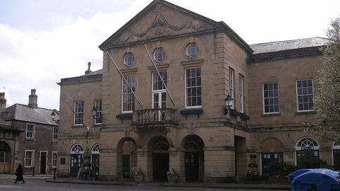 Where to Stay in the Brecon Beacons Ranked by What You Can Reach on Foot
The best base in Bannau Brycheiniog is the one where you can lace your boots and walk onto the hill. Here is every town ranked by what leaves from the door.
Where to Stay in the Brecon Beacons Ranked by What You Can Reach on Foot
The best base in Bannau Brycheiniog is the one where you can lace your boots and walk onto the hill. Here is every town ranked by what leaves from the door.
-
 Flying into Bannau Brycheiniog via Cardiff Bristol and Birmingham
Flying into Bannau Brycheiniog: how to reach the park by train and bus from Cardiff, Bristol and Birmingham airports, with taxi costs where public transport fails.
Flying into Bannau Brycheiniog via Cardiff Bristol and Birmingham
Flying into Bannau Brycheiniog: how to reach the park by train and bus from Cardiff, Bristol and Birmingham airports, with taxi costs where public transport fails.
-
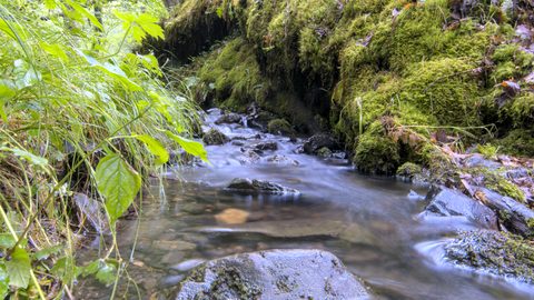 Things to Do in Bannau Brycheiniog Sorted by Whether You Have a Car
Some of Bannau Brycheiniog's finest walks begin at bus stops. Others require a taxi or a long approach on foot. Here is every major activity sorted by access.
Things to Do in Bannau Brycheiniog Sorted by Whether You Have a Car
Some of Bannau Brycheiniog's finest walks begin at bus stops. Others require a taxi or a long approach on foot. Here is every major activity sorted by access.
-
 Best Time to Visit Bannau Brycheiniog Month by Month Including Daylight Hours
August brings queues to Pen y Fan's summit, November loses the light by four, and the Royal Welsh Show swallows every bed for miles. Here is the park month by month.
Best Time to Visit Bannau Brycheiniog Month by Month Including Daylight Hours
August brings queues to Pen y Fan's summit, November loses the light by four, and the Royal Welsh Show swallows every bed for miles. Here is the park month by month.
-
 Getting Around the Brecon Beacons Without a Car: What Runs and What Does Not
No bus reaches the trailheads of Bannau Brycheiniog. Here is what the TrawsCymru network does serve, and what to do when the tarmac runs out.
Getting Around the Brecon Beacons Without a Car: What Runs and What Does Not
No bus reaches the trailheads of Bannau Brycheiniog. Here is what the TrawsCymru network does serve, and what to do when the tarmac runs out.
-
 Pen y Fan
 can be climbed from the Storey Arms bus stop on the TrawsCymru corridor, with quieter alternatives from Cwm Gwdi and a long walk-in from Brecon.
Pen y Fan
Pen y Fan can be climbed from the Storey Arms bus stop on the TrawsCymru corridor, with quieter alternatives from Cwm Gwdi and a long walk-in from Brecon.
-
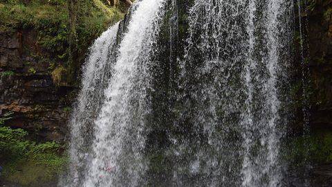 Waterfall Country
's Four Waterfalls Walk is reachable by a long road-walk from the nearest bus stop or by taxi from Abergavenny station, with slippery paths year-round.
Waterfall Country
Waterfall Country's Four Waterfalls Walk is reachable by a long road-walk from the nearest bus stop or by taxi from Abergavenny station, with slippery paths year-round.
-
 Llangorse Lake
 is a short, flat walk from the bus stop on the TrawsCymru corridor from Brecon, with a crannog, bird hides, and watersports at the water's edge.
Llangorse Lake
Llangorse Lake is a short, flat walk from the bus stop on the TrawsCymru corridor from Brecon, with a crannog, bird hides, and watersports at the water's edge.