Car-free dog walks in the Brecon Beacons and where you can roam
Plan car-free dog walks in the Brecon Beacons with named stations and bus stops, realistic walking distances, return travel and countryside access advice.
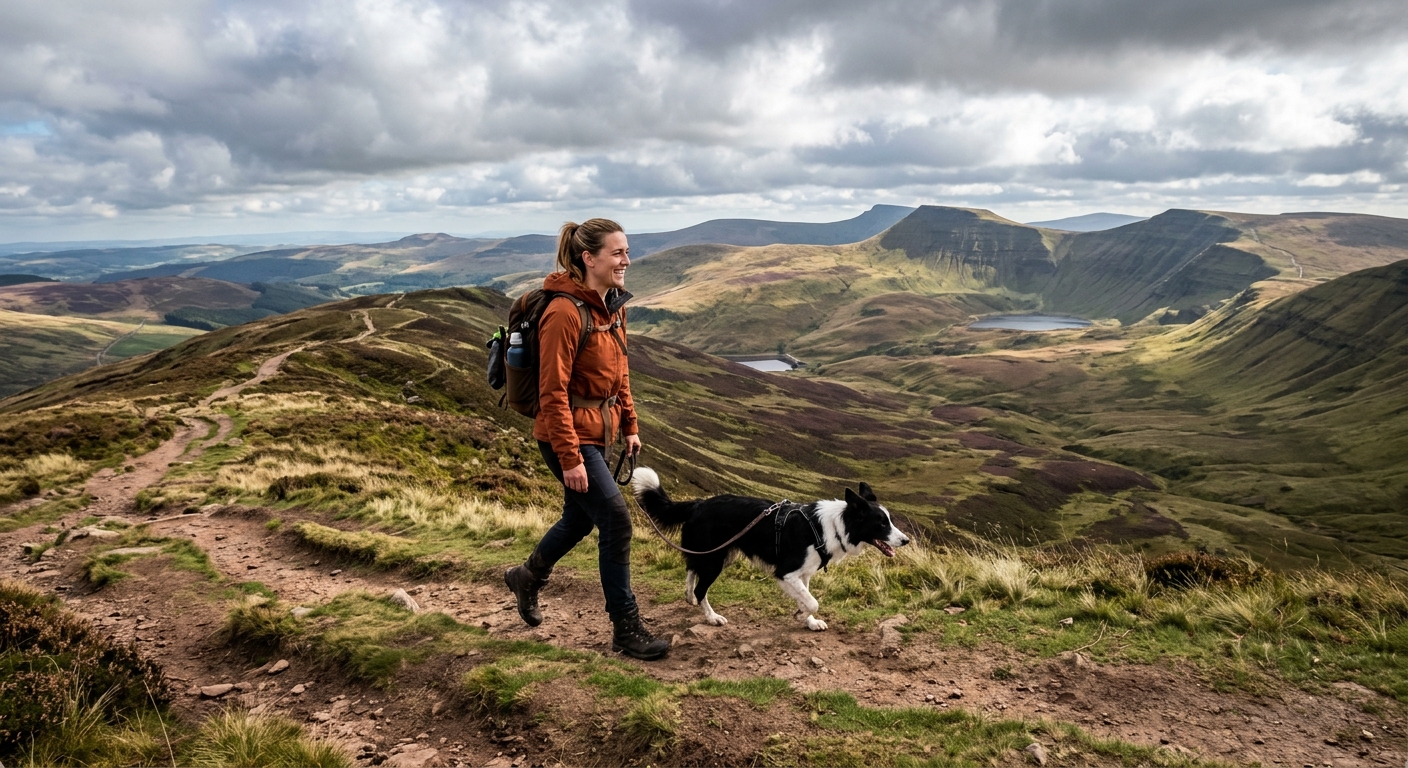
A good dog walk should finish with muddy boots and a contented companion, rather than a frantic search for the last bus. In the Brecon Beacons, also called Bannau Brycheiniog, that means choosing your starting stop as carefully as your path. Canal towpaths, wooded grounds and open hills all offer rewarding days without a car. The trick is matching the terrain to your dog, then leaving enough time to get home.
Build the walk around a return journey you can comfortably catch.
- Choose Abergavenny for a railway start, Brecon for canal walking, or Craig y Nos for shorter woodland outings.
- Treat distances below as approximate planning figures, including the approach from the named transport point.
- Keep a lead handy throughout. Access rights, livestock and local signs determine where dogs can go.
Plan the Journey Before Choosing the Path
Start by checking both directions for your actual travel date. Sunday and bank holiday services may offer fewer choices. Engineering works can change rail journeys, and replacement buses may have different arrangements for dogs.
Ask the operator about its current dog policy before buying tickets. Ordinary pet dogs may travel subject to conditions, available space and driver discretion on buses. Check any charges and limits if travelling with several dogs. Keep your dog on the floor, clear of the aisle, with a towel ready for wet paws.
Allow a generous transfer between train and bus. A station and a town's main bus station are not necessarily next door. At Merthyr Tydfil, allow around 15 minutes to walk between the railway station and bus station, plus waiting time. Cardiff passengers can use rail to Merthyr and connect with the T4 towards Brecon. Do not assume an older description of a direct Cardiff T4 still applies.
The following walks use return routes or adjustable circuits. That gives you control over the distance without depending on a second rural pickup point. Walking times exclude the outward public transport journey and allow only modest pauses.
Walk From Abergavenny Station to Llanfoist and the Canal
Start and finish: Abergavenny railway station. Suggested distance: roughly 8 to 10 km. Allow: 3 to 4 hours, including sniffing stops and the town approach.
Abergavenny is a useful eastern gateway for travellers arriving through Newport or Hereford. This outing suits dogs comfortable with pavements before the quieter walking begins. The station is not beside the canal, so include the approach in your energy budget.
Use a mapped pedestrian route from the station towards the town centre, then head towards Llanfoist using the pavement beside the A4143 and its river crossing. Continue to the signed canal access near Llanfoist Church. Allow roughly 45 to 60 minutes from the station to the towpath, depending on your chosen streets and walking pace.
Once beside the Monmouthshire and Brecon Canal, turn towards Govilon. For an adjustable outing, walk for another 30 to 45 minutes before retracing your steps. You do not need to reach another village to make this a satisfying day.
The approach has road crossings and a climb to canal level. The towpath is gentler, but sections can be narrow, muddy or slippery beneath leaves. Keep your dog close at bridges and when cyclists or other walkers pass. Avoid throwing toys into the water. Steep edges and passing boats make swimming a poor default activity.
Return travel: walk back to Abergavenny station by the same approach. Set a turnaround alarm that leaves time for the full walk back, a drink and a platform check. This route works particularly well when you want a railway outing without adding a bus connection.
Follow the Canal From Brecon Interchange
Start and finish: Brecon Interchange, Heol Gouesnou. Suggested distance: approximately 5 to 7 km. Allow: 2 to 3 hours.
Brecon has no railway station. Arrive by bus, with the T4 providing a connection from Merthyr Tydfil and the T6 serving the Swansea and Neath corridor. Check the complete journey home before setting off, especially if your return involves a train.
From the interchange, use town pavements towards the canal basin beside Theatr Brycheiniog. Allow around 10 to 15 minutes. Join the towpath and follow the canal away from the basin towards Brynich. Turn back after roughly 2 to 3 km of towpath walking, adjusting the distance to the weather and your dog's pace.
This is a useful choice when the hills are hidden in cloud. Most of the route is comparatively level in the everyday sense, although access points and surfaces still need attention. Expect wet patches, narrow stretches and occasional puddles after rain. A level route does not automatically mean an accessible surface throughout.
Keep the lead short enough to avoid blocking the towpath. Pause at a wider section when someone needs to pass. Carry drinking water rather than relying on canal water, which may contain hazards you cannot see.
Return travel: retrace the towpath to the basin and walk back to Brecon Interchange. Aim for a bus earlier than the final workable departure. If you arrive back early, a short town wander is easier to manage than an anxious final kilometre.
Understand Where Your Dog Can Roam
A national park boundary does not grant unrestricted access to every field, woodland or riverbank. Three different arrangements shape these walks: public rights of way, mapped open-access land and paths provided under local permission. General reading about UK law offers background context, but your route needs its own access checks and attention to signs on the ground.
Public Rights of Way Follow Defined Routes
A public footpath gives you a right to walk along its route. It does not normally grant permission to wander across the surrounding field. Dogs can generally accompany walkers, but must remain under close control and must not stray onto adjoining land. A bridleway also allows walking, although you will share it with other permitted users.
A lead is sensible around stock, narrow paths and unfamiliar dogs. Gates and stiles can be a greater obstacle than distance. Never assume a large dog can pass a stile safely, and do not lift a heavy dog over an obstacle unless you can manage it securely.
Open-Access Land Has Separate Dog Conditions
Mapped access land allows walking beyond public paths, subject to restrictions. It is not a promise that every visible slope is open, nor does it include automatic rights to camp or swim.
The national park authority's access guidance states that dogs on access land must be on a fixed lead no longer than two metres between 1 March and 31 July, and whenever near livestock. Temporary restrictions can also apply. Existing public rights of way have a separate legal basis, so check which right you are using before interpreting a restriction.
Local Restrictions Still Apply
Country parks, permissive paths and managed grounds may require leads throughout. Some areas exclude dogs temporarily, including land being grazed. Follow the current notices rather than assuming a previous visit gives you permission today.
If cattle approach aggressively, release your dog if necessary to let you both reach safety separately. Avoid entering a field where animals already appear unsettled. Pick up dog waste and carry it to a suitable bin, even on remote ground.
Take the T6 to Craig y Nos Country Park
Start and finish: Craig-y-Nos Country Park bus stops on the A4067. Some timetable directions use Craig-y-Nos Castle. Suggested distance: approximately 2 to 4 km within the grounds. Allow: 1 to 2 hours.
This is the gentler option for a dog that enjoys frequent pauses. Travel on the T6 from Brecon or from the Swansea and Neath direction. If arriving by train, check the walk between your railway arrival and the relevant bus stop. Swansea railway station and Swansea bus station require a separate town transfer.
Confirm the stop name and your return departure using the current T6 timetable. Tell the driver where you want to alight. On arrival, identify the return stop before entering the park, including whether you will need to cross the road.
Build a short circuit using the signed paths around the ponds, trees and riverside grounds. Add another loop only if your dog and the timetable allow it. These are landscaped grounds with woodland sections, rather than a mountain route, but roots, wet leaves and muddy edges still call for footwear with grip.
Dogs must stay on leads here. The hay meadow is unavailable to dogs when sheep graze there in winter. Keep to the other permitted paths and obey notices. Do not extend the outing onto surrounding hills simply because a track looks inviting.
Return travel: return to the main entrance with at least 15 minutes to spare. Check refreshment and toilet opening arrangements separately from the bus timetable. Carry enough food and water to manage a closed café.
Save Storey Arms for a Suitable Mountain Day
Start and finish: Storey Arms bus stop, served by the T4. Suggested distance: approximately 7 to 9 km for an out-and-back towards Corn Du, depending on your exact path. Allow: 4 to 5 hours with a dog.
This is a substantial step up from the canal walks. Use the mapped mountain path beginning beside Storey Arms and retrace it for a straightforward return. Check your navigation before leaving the stop. Storey Arms and Pont ar Daf are separate starting points, and their route descriptions should not be treated as interchangeable.
Expect sustained climbing, rough stone, wet ground and exposed upper slopes. Corn Du reaches 873 metres. Wind and cloud can make the summit area much colder than the bus stop. Keep your dog away from steep edges and follow livestock and access restrictions throughout.
Choose this outing only if both of you are accustomed to mountain walking. Turn back below the summit if the weather deteriorates or your dog tires. Shortening a mountain walk is a sound decision, particularly when the return depends on a rural bus.
Return travel: catch the T4 towards Brecon or Merthyr Tydfil, as planned. Confirm the correct roadside waiting point in advance. The A470 is busy, so keep your dog close and avoid unnecessary crossings.
Pack for Wet Paws and Rural Waiting Times
A modest kit makes these journeys more comfortable:
- A fixed lead, secure harness and identification tag.
- Water, a bowl, food and waste bags.
- A towel and a small mat for waiting on cold ground.
- Waterproof clothing, suitable footwear and an offline route map.
- A charged phone, backup power and saved return journey details.
Use this routine before each outing:
- Check the day's outward and return services, including every connection.
- Confirm dog carriage conditions and any local access restrictions.
- Save the route, stop locations and a shorter walking option offline.
- Set a turnaround time that leaves a generous margin before departure.
Finish With Time for One Last Sniff
The best car-free dog walk is the one that fits the whole day. Abergavenny offers a railway start with a longer approach. Brecon gives you adjustable canal mileage. Craig y Nos suits a shorter outing, and Storey Arms demands mountain fitness and settled conditions.
Choose the route your dog will enjoy, keep the return journey comfortably within reach, and let the spare time belong to the walk. There is usually another interesting scent just before the bus stop.