The Beacons Way: Eight Days Across the Park, East to West, Using Buses at Each End
The Beacons Way crosses Bannau Brycheiniog from Abergavenny station to Llangadog. Here is how to manage the start, finish, and baggage logistics without a car.


The Beacons Way Without a Car: Eight Days Across Bannau Brycheiniog
Yes, you can walk the Beacons Way without a car. The logistics are straightforward at each end, provided you solve the start and finish problem before you lace up. Abergavenny railway station is your natural eastern trailhead, served by Transport for Wales trains from Cardiff and Manchester. The western end near Bethlehem has no railway station. You will walk 99 miles (159 km) east to west over eight stages, and you need a bus or taxi from the finish point to Llandovery station on the Heart of Wales line. That is the single biggest planning hurdle. Here is exactly how to clear it.
Getting to and from the Trailheads by Public Transport
The route runs from Abergavenny (Y Fenni) in the east to Bethlehem in Carmarthenshire in the west. Abergavenny station is on the Welsh Marches Line, with direct trains from Cardiff and Manchester. From the station, you walk 10 minutes to the trail start at the Holy Mountain car park. No taxi required.
Solving the Western End
At the western end, your problem is the Carmarthenshire finish. No bus serves the village. The nearest railway station is Llandovery, 12 miles north, on the Heart of Wales line. This branch runs a sparse timetable. You have two options. Book a taxi ahead from Llandovery cabs. Or walk the road from the finish to Llangadog village, which has a limited TrawsCymru service to Llandovery. Check Traveline Cymru for live times before you travel. Book the taxi. It costs less than the stress of a missed connection.
Mid-Route Bailouts Are Rare
Between the trailheads, you stay on foot. The bus network (Stagecoach South Wales, First Cymru) connects towns like Brecon, Crickhowell and Storey Arms, but services are infrequent and skip virtually every trailhead. You cannot rely on them to skip a stage or to bail out mid-route. The Beacons Way is a through-hike, not a series of day walks linked by buses.
Accommodation, Baggage Transfer and Navigation
Book Every Bed In Advance
Accommodation is scarce, especially from Stage 5 (Storey Arms) westward through Craig-y-nos, Llanddeusant and the final villages. These are farming hamlets with one B&B if you are lucky. Book every night before you leave home, at least six weeks ahead for April to September. The Royal Welsh Show week in late July and the Brecon Jazz Festival weekend in August flood every room within 40 miles. Check the Welsh show dates before you fix departure.
Baggage Transfer Operators
Two companies run door-to-door baggage transfer for the full route: Celtic Trails and Walk the Beacons Way. You book each night's accommodation first, then the operator collects from reception and drops at the next. Arrange this three weeks ahead. The operators will not take a last-minute booking on a Friday evening.
Offline Maps Are Not Optional
Mobile signal vanishes on Stages 4, 5 and 6. EE and Vodafone offer the least patchy 4G on the high ridges, but Waterfall Country and the Black Mountain are dead zones. Download OS Explorer OL12 (west) and OL13 (east) onto your phone before you leave. Carry a paper map and compass. The waymarking is sparse in the western sections. Navigation is critical on Stage 4 (Pen y Fan summit in hill fog) and Stage 6 (Black Mountain, no facilities en route). The single failure case here is a walker who trusts the phone and gets disoriented in cloud at 2pm with five hours of daylight left.
Mountain Safety Is The Story Of This Walk
This is a serious upland traverse, not a waymarked canal path. Stage 4 reaches 886 metres on Pen y Fan, the highest point in southern Britain. Weather turns from sunshine to disorienting hill fog in 20 minutes, even in July. Carry a waterproof jacket and trousers, a warm layer, food for an extra half-day, and a head torch. The MOD firing range at Sennybridge closes large sections of the western park without much online notice. Check red flags before you set out each morning.
Why Walk East to West
Walk east to west. This puts the prevailing wind at your back and the sun behind you for most of the day. The hardest stages come in the middle and the west. Stage 3 (Crickhowell to Llangynidr) is moderate, then Stage 4 (Llangynidr to Storey Arms via Pen y Fan) is strenuous. Stages 5 and 6 are both rated strenuous, with boggy sections, no facilities, and navigation that demands full attention. Save your legs for these. Stage 8 (Carreg Cennen to the finish) is easy to moderate, a gentle finale across lanes and fields.
The Eight Stages in Brief
Stage 1 runs 13 miles from Abergavenny to Llanthony, climbing the Holy Mountain (Ysgyrd Fawr) on open moorland. Stage 2 covers 12 miles from Llanthony to Crickhowell, a strenuous exposed ridge on the Hatterrall Ridge. Stage 3 is 11 miles of canal towpath and river valley with one steep climb up Table Mountain. Stage 4 is 14 miles across the central Beacons, summitting Pen y Fan. Stage 5 is 12 miles through Fforest Fawr Geopark to Craig-y-nos, boggy and moderate to strenuous. Stage 6 is 12 miles across the Black Mountain to Llanddeusant, serious ground with Llyn y Fan Fach as the landmark. Stage 7 is 11 miles of rolling farmland to Carreg Cennen Castle. Stage 8 finishes with 10 miles to the western trailhead.

.jpg)
What to Pack and What to Leave Behind
Pack for four seasons in one day. The Brecon Beacons is an upland massif, not a lowland park. Carry waterproof jacket and trousers, a mid-layer, hat and gloves even in August. Your phone is not your navigation tool; it is your backup. Download offline maps on OS Maps or AllTrails before you leave your accommodation, not at the trailhead cafe. There often is no cafe. Budget for a head torch and a power bank.
Leave behind expectations of guaranteed views. The peaks are frequently shrouded in cloud. Leave behind the assumption that you can charge a phone at a pub halfway through Stage 6. You cannot. Leave behind the idea that you will buy food en route. The remote west has no shops. Carry daily provisions from the last town.
Who This Walk Suits and Who Should Skip it
This walk suits hikers who prioritise solitude over facilities and who are comfortable with self-sufficiency for six hours at a stretch. It suits people who can navigate with a map when the cloud drops to 50 metres. It suits those who book ahead and stick to the plan.
This walk is not for anyone reliant on public transport to reach remote trailheads. It is not for walkers who expect a pub at the end of every stage. The single thing that most often goes wrong here is a walker who underestimates the gap between villages and the lack of any backup on the western half. Plan for that gap before you leave Abergavenny station and you will be fine.
Read next
-

 Brecon Beacons Hotels: Country Houses, Coaching Inns and the Festival Premium
The best hotels in Bannau Brycheiniog are those you can reach by train or bus. Here are the coaching inns and country houses with a bus stop or platform nearby.
Brecon Beacons Hotels: Country Houses, Coaching Inns and the Festival Premium
The best hotels in Bannau Brycheiniog are those you can reach by train or bus. Here are the coaching inns and country houses with a bus stop or platform nearby.
-
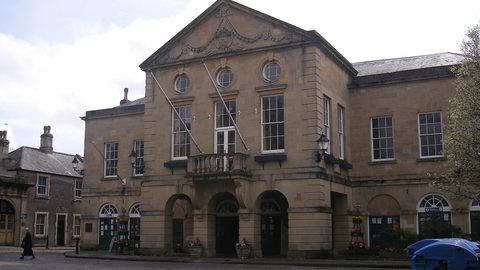 Where to Stay in the Brecon Beacons Ranked by What You Can Reach on Foot
The best base in Bannau Brycheiniog is the one where you can lace your boots and walk onto the hill. Here is every town ranked by what leaves from the door.
Where to Stay in the Brecon Beacons Ranked by What You Can Reach on Foot
The best base in Bannau Brycheiniog is the one where you can lace your boots and walk onto the hill. Here is every town ranked by what leaves from the door.
-
 Flying into Bannau Brycheiniog via Cardiff Bristol and Birmingham
Flying into Bannau Brycheiniog: how to reach the park by train and bus from Cardiff, Bristol and Birmingham airports, with taxi costs where public transport fails.
Flying into Bannau Brycheiniog via Cardiff Bristol and Birmingham
Flying into Bannau Brycheiniog: how to reach the park by train and bus from Cardiff, Bristol and Birmingham airports, with taxi costs where public transport fails.
-
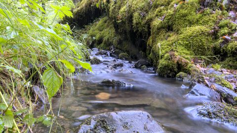 Things to Do in Bannau Brycheiniog Sorted by Whether You Have a Car
Some of Bannau Brycheiniog's finest walks begin at bus stops. Others require a taxi or a long approach on foot. Here is every major activity sorted by access.
Things to Do in Bannau Brycheiniog Sorted by Whether You Have a Car
Some of Bannau Brycheiniog's finest walks begin at bus stops. Others require a taxi or a long approach on foot. Here is every major activity sorted by access.
-
 Best Time to Visit Bannau Brycheiniog Month by Month Including Daylight Hours
August brings queues to Pen y Fan's summit, November loses the light by four, and the Royal Welsh Show swallows every bed for miles. Here is the park month by month.
Best Time to Visit Bannau Brycheiniog Month by Month Including Daylight Hours
August brings queues to Pen y Fan's summit, November loses the light by four, and the Royal Welsh Show swallows every bed for miles. Here is the park month by month.
-
 Getting Around the Brecon Beacons Without a Car: What Runs and What Does Not
No bus reaches the trailheads of Bannau Brycheiniog. Here is what the TrawsCymru network does serve, and what to do when the tarmac runs out.
Getting Around the Brecon Beacons Without a Car: What Runs and What Does Not
No bus reaches the trailheads of Bannau Brycheiniog. Here is what the TrawsCymru network does serve, and what to do when the tarmac runs out.
-
 Pen y Fan
 can be climbed from the Storey Arms bus stop on the TrawsCymru corridor, with quieter alternatives from Cwm Gwdi and a long walk-in from Brecon.
Pen y Fan
Pen y Fan can be climbed from the Storey Arms bus stop on the TrawsCymru corridor, with quieter alternatives from Cwm Gwdi and a long walk-in from Brecon.
-
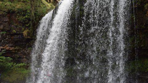 Waterfall Country
's Four Waterfalls Walk is reachable by a long road-walk from the nearest bus stop or by taxi from Abergavenny station, with slippery paths year-round.
Waterfall Country
Waterfall Country's Four Waterfalls Walk is reachable by a long road-walk from the nearest bus stop or by taxi from Abergavenny station, with slippery paths year-round.
-
 Llangorse Lake
 is a short, flat walk from the bus stop on the TrawsCymru corridor from Brecon, with a crannog, bird hides, and watersports at the water's edge.
Llangorse Lake
Llangorse Lake is a short, flat walk from the bus stop on the TrawsCymru corridor from Brecon, with a crannog, bird hides, and watersports at the water's edge.