Easier-Access Trips and Gentle Days Out in Bannau Brycheiniog
Accessible and gentle days out in Bannau Brycheiniog that don't need a mountain or a car, from the Brecon canal towpath to the Brecon Mountain Railway and Big Pit.

.jpg)
Six Accessible Days Out Reachable Without a Car
You do not need a car to enjoy the Brecon Beacons. You need a bus timetable and realistic expectations. The park is vast and public transport skips most trailheads. But a handful of genuinely accessible, level days out sit within walking distance of bus stops or railway stations. Here are six that work for wheelchairs, limited mobility, or total refusal to climb a mountain. Each one includes the transport route so you can plan before you arrive. Check Traveline Cymru for live times before you travel.
The Monmouthshire and Brecon Canal Towpath from Brecon Town
Why it works: a level, surfaced path running beside still water with zero gradient. The Monmouthshire and Brecon Canal towpath from Brecon to Brynich is compacted gravel and tarmac, wide enough for two wheelchairs to pass, with no stiles or steps.
Getting There And The Route
Getting there: take any bus that stops at Brecon town centre. The T4 from Cardiff or the T14 from Abergavenny both drop you a short push from the canal basin. Exit the bus at Brecon Interchange, head south on the road toward the theatre, and you reach the waterside path at Brecon Basin. The nearest accessible toilet is inside Theatr Brycheiniog at the basin itself.
The walk: follow the canal south toward Brynich. The full accessible section runs about 2.5 miles one way. You pass narrowboats moored on your left, fields on your right, and the only sounds are water lapping and herons taking off. Turn around whenever you want. The surface stays good all the way to the Brynich lock. Allow 45 minutes each way at a slow roll, or push an hour with stops.
When The Canal Floods
Fallback: if the canal path is flooded after heavy rain, which happens two or three times a winter, backtrack to Brecon town and use the surfaced paths along the River Usk. The Usk path starts at the same basin and runs 1.2 miles east to the bridge. Same bus route out.
Brecon Mountain Railway: Accessible Carriage, Bus to Pant
Why it works: a vintage steam train running 5.5 miles through the Taf Fechan reservoir valley, and the railway operates one wheelchair accessible carriage. Book it. You board at Pant, ride up to Torpantau, and the views across the reservoirs open without you lifting a foot.
Getting To Pant
Getting there: Pant is the start point, not the main car park at Merthyr Tydfil. Stagecoach South Wales bus service 35 runs from Merthyr Tydfil bus station to Pant. Merthyr Tydfil railway stop is on the Transport for Wales line from Cardiff. From the bus stop at Pant, the entrance is a level push across tarmac. The bus runs roughly every 90 minutes on weekdays. Advance booking is advised for the accessible carriage; call the railway directly at least 48 hours ahead.
What it costs: the 2025 day return fare was £14 for adults, £8 for children, with a companion free for Blue Badge holders. The railway publishes these rates on its own site; confirm before booking.
The Ride And The Fallback
The accessible carriage: a converted coach with a wheelchair ramp, securing points, and a window you can open. The carriage is on the rear of the train, so you board last and exit first. The platform is level with the carriage floor at Pant. At Torpantau, the platform is also level, though the cafe there has a small step at the door. Staff will lift a chair over it if you ask.
Fallback: if the accessible carriage is already booked, take the Taf Fechan boardwalk instead. It starts at Pontsticill car park, reachable by the same bus 35. The boardwalk is level timber and ends at a viewpoint over the reservoir. Nearest accessible toilet is at Pontsticill car park, but verify it is open before you go; the 2025 access guide flagged this as unconfirmed.
Big Pit National Coal Museum: Book the Underground Slot
Why it works: the underground tour is fully accessible in one specific time slot. You descend 90 metres in a cage lift, then ride a battery powered vehicle along the coal seams. The surface exhibition halls are level, with wide doors and accessible toilets at the visitor centre.
Reaching Big Pit
Getting there: Stagecoach bus X24 runs from Abergavenny bus station to Big Pit. Journey time is 25 minutes. The bus stop is immediately outside the museum entrance. Abergavenny railway stop is on the Manchester to Cardiff line, a short walk from the bus station. Buses run every 60 to 90 minutes on weekdays. On Sundays, no bus serves Big Pit; you must use a taxi from Abergavenny, which costs approximately £20 each way.
Booking The Right Tour
What to book: the accessible underground tour slot must be pre booked by phone. Do not just turn up. The general tour requires climbing steps at the exit. The accessible tour uses a separate entrance and a level exit. Call Big Pit direct and ask for the accessible tour. Specify that you do not have a car and need the bus arrival time matched to the tour start. The museum is free, but donation requested.
Fallback: if the accessible slot is full, skip the underground and spend your time on the surface. The pithead baths, the winding engine house, and the blacksmith shop are all step free. The museum grounds have a level path around the spoil heap. You still get the coal dust atmosphere. Then catch the bus back to Abergavenny and take the canal towpath there, which runs level for 3 miles toward Llanfoist.
The Crannog at Llangorse Lake and the Level Lake Path
Why it works: a reconstructed Iron Age dwelling on a small island, reached by a ramp from the shore. The path along Llangorse Lake is compacted gravel, level, and runs to a bird hide. The entire route is pushchair and wheelchair friendly.
The Journey To The Lake
Getting there: the T4 bus, operated by Stagecoach, runs from Brecon to Llangorse village. Journey time is 25 minutes. The bus stops at the village centre, then you push north on a minor road to the lake car park. The road is quiet, with a narrow verge; push on the grass if traffic comes. The T4 runs roughly hourly on weekdays, every two hours on Saturdays. No Sunday service. From the car park, the path to the crannog is level gravel all the way. Accessible toilet at the car park requires a RADAR key; bring your own or get one from the National Park Visitor Centre in Libanus before you travel.
What it costs: the crannog charges a small fee, around £5 for adults in 2025. The lake path is free.
What You See
The experience: the crannog reconstruction sits on a platform above the water. The ramp is wide and gradual. Inside, the thatched roundhouse has a compacted earth floor; a wheelchair can enter but turning space is tight. The real draw is the lake itself, the largest natural lake in South Wales, with reedbeds and swans at the edge. The bird hide at the far end of the path is fully accessible with a viewing window at wheelchair height.
Fallback: if the crannog is closed, which it often is outside the Easter to October season, the lake path itself is still worth the bus ride. Push to the bird hide, sit, watch whooper swans in winter, and catch the next T4 back.
Craig Y Nos Country Park: Tarmac Loops in a Victorian Garden
Why it works: a former estate park with tarmac paths, a gentle loop, and a visitor centre with accessible toilets. The gradient never exceeds 1:15 except for a single short section that still passes wheelchair limits.
Arriving And Walking
Getting there: First Cymru bus service T6 runs from Swansea to Brecon via Ystradgynlais and stops directly outside Craig y Nos. The bus runs roughly hourly on weekdays. From Brecon, the same bus passes through at the top of the hour. Journey time from Brecon is 30 minutes. The park entrance is a short push from the bus stop on the main road. Blue Badge parking spaces exist inside the car park, but you do not need them because the bus drops you at the gate.
The walk: the tarmac loop passes the grotto, the ice house, and the river Tawe. The surface is smooth enough for manual wheelchairs. Benches are frequent. The entire loop takes 20 minutes at a slow roll. Extend by pushing along the riverbank path to the old stable block, where the ground stays firm but becomes compacted earth. The visitor centre has a cafe with level access and an accessible toilet inside.
Fallback: if the T6 bus is cancelled, which is most likely on Sundays when no service runs, you are stranded. Do not rely on a taxi from Brecon; they rarely accept a wheelchair user because the vehicle is unsuitable. Instead, if you arrive on a Sunday, pick the canal towpath in Brecon, which never needs a bus.


The Four Waterfalls Walk is Not Accessible. Ignore Any Leaflet That Says Otherwise
The Four Waterfalls Walk is the most common disappointment for visitors seeking accessible days out in the Brecon Beacons without a car. Leaflets and some council websites label it accessible. They are wrong. The main path is a steep, uneven, slick rock descent into a gorge. The steps to Sgwd yr Eira are cut into wet stone and have no handrail. Wheelchairs cannot descend. Walkers with limited mobility will struggle on the return climb. The only accessible waterfall in the national park is the Sychryd All Abilities Trail at Dinas Rock. It is a 1 km one way trail of compacted stone dust and boardwalk, mostly level with a maximum gradient of 1:20. It ends at a viewing platform over the Sychryd gorge. You need a RADAR key for the kissing gates and for the accessible toilet at the Dinas Rock car park. There are four Blue Badge parking spaces at Dinas Rock car park. The bus does not reach Dinas Rock; you need a taxi from Glynneath or a pre booked community transport. If you cannot arrange that, skip the waterfalls entirely and choose the canal towpath instead.
Bus Reality Check: Frequencies, Sundays, and What to Do When it Fails
Buses in the Brecon Beacons are sparse. The T4 between Brecon and Abergavenny runs roughly hourly on weekdays. The T6 from Swansea to Brecon runs roughly hourly. The Celtic Travel service from Brecon to Llandovery via Trecastle runs only a handful of journeys per weekday. On Sundays, the T4 and T6 both stop. The X24 to Big Pit stops.
If you are stranded on a Sunday, your options shrink to three: the Brecon canal towpath, the level river path along the Usk in Brecon town, or the Taf Fechan boardwalk, which is reachable only by taxi from Merthyr Tydfil. Download the offline map of your chosen route before you leave accommodation. Mobile signal vanishes in the valleys. EE and Vodafone offer the least patchy 4G on ridges, but Waterfall Country and the Black Mountain are dead zones. Do not rely on cafe Wi Fi at the trailhead; there often is no cafe.
Traveline Cymru (traveline.cymru) is the single source for up to date bus times. Check it the evening before you travel and again the morning of your trip. The 2025 Bannau Brycheiniog National Park Authority access guide lists all RADAR key locations and all Blue Badge parking counts printed above. Use the 2025 edition; the authority revises it annually and the 2026 edition may add or remove sites.
Getting Here Without a Car
Access without a car in the Brecon Beacons means arriving by train or bus. Visa, entry rules, currency, and power sockets are the same as the rest of the UK. Cardiff and Swansea are beyond the park bus and rail gateways. Welsh history unconnected to the ground you push across is not here. Arrive at Abergavenny or Merthyr Tydfil station by train, or at Brecon by bus from Cardiff or Swansea. If you fly into Cardiff Airport, take the bus to Cardiff Central, then the train to Merthyr Tydfil or Abergavenny. The taxi from Cardiff Airport to Brecon costs £70 to £90 and is not recommended.
Read next
-

 Brecon Beacons Hotels: Country Houses, Coaching Inns and the Festival Premium
The best hotels in Bannau Brycheiniog are those you can reach by train or bus. Here are the coaching inns and country houses with a bus stop or platform nearby.
Brecon Beacons Hotels: Country Houses, Coaching Inns and the Festival Premium
The best hotels in Bannau Brycheiniog are those you can reach by train or bus. Here are the coaching inns and country houses with a bus stop or platform nearby.
-
 Where to Stay in the Brecon Beacons Ranked by What You Can Reach on Foot
The best base in Bannau Brycheiniog is the one where you can lace your boots and walk onto the hill. Here is every town ranked by what leaves from the door.
Where to Stay in the Brecon Beacons Ranked by What You Can Reach on Foot
The best base in Bannau Brycheiniog is the one where you can lace your boots and walk onto the hill. Here is every town ranked by what leaves from the door.
-
 Flying into Bannau Brycheiniog via Cardiff Bristol and Birmingham
Flying into Bannau Brycheiniog: how to reach the park by train and bus from Cardiff, Bristol and Birmingham airports, with taxi costs where public transport fails.
Flying into Bannau Brycheiniog via Cardiff Bristol and Birmingham
Flying into Bannau Brycheiniog: how to reach the park by train and bus from Cardiff, Bristol and Birmingham airports, with taxi costs where public transport fails.
-
 Things to Do in Bannau Brycheiniog Sorted by Whether You Have a Car
Some of Bannau Brycheiniog's finest walks begin at bus stops. Others require a taxi or a long approach on foot. Here is every major activity sorted by access.
Things to Do in Bannau Brycheiniog Sorted by Whether You Have a Car
Some of Bannau Brycheiniog's finest walks begin at bus stops. Others require a taxi or a long approach on foot. Here is every major activity sorted by access.
-
 Best Time to Visit Bannau Brycheiniog Month by Month Including Daylight Hours
August brings queues to Pen y Fan's summit, November loses the light by four, and the Royal Welsh Show swallows every bed for miles. Here is the park month by month.
Best Time to Visit Bannau Brycheiniog Month by Month Including Daylight Hours
August brings queues to Pen y Fan's summit, November loses the light by four, and the Royal Welsh Show swallows every bed for miles. Here is the park month by month.
-
 Getting Around the Brecon Beacons Without a Car: What Runs and What Does Not
No bus reaches the trailheads of Bannau Brycheiniog. Here is what the TrawsCymru network does serve, and what to do when the tarmac runs out.
Getting Around the Brecon Beacons Without a Car: What Runs and What Does Not
No bus reaches the trailheads of Bannau Brycheiniog. Here is what the TrawsCymru network does serve, and what to do when the tarmac runs out.
-
 Pen y Fan
 can be climbed from the Storey Arms bus stop on the TrawsCymru corridor, with quieter alternatives from Cwm Gwdi and a long walk-in from Brecon.
Pen y Fan
Pen y Fan can be climbed from the Storey Arms bus stop on the TrawsCymru corridor, with quieter alternatives from Cwm Gwdi and a long walk-in from Brecon.
-
 Waterfall Country
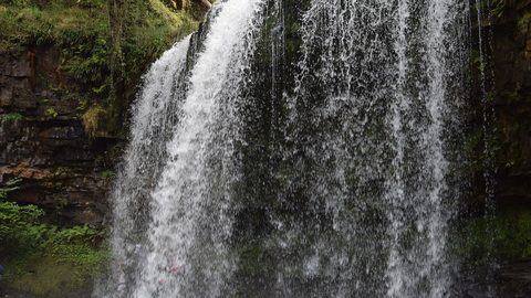
's Four Waterfalls Walk is reachable by a long road-walk from the nearest bus stop or by taxi from Abergavenny station, with slippery paths year-round.
Waterfall Country
Waterfall Country's Four Waterfalls Walk is reachable by a long road-walk from the nearest bus stop or by taxi from Abergavenny station, with slippery paths year-round.
-
 Llangorse Lake
 is a short, flat walk from the bus stop on the TrawsCymru corridor from Brecon, with a crannog, bird hides, and watersports at the water's edge.
Llangorse Lake
Llangorse Lake is a short, flat walk from the bus stop on the TrawsCymru corridor from Brecon, with a crannog, bird hides, and watersports at the water's edge.